
The National Weather Service in Portland reports there is a small chance that a few thunderstorms and showers could become strong enough Wednesday afternoon or early evening to reach severe levels.
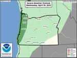
The National Weather Service in Portland said what appears to be a precise eastern edge of the dark green cut-off risk area on the map is misleading since it was made at a national scale. The threat of severe weather appears highest throughout the Willamette Valley.
National Weather Service
This poses risks of damaging wind gusts up to 60 mph, the weather agency said, as well as large hail up to one inch in diameter.
Wind gusts on Wednesday are the most likely type of severe weather western Oregon faces.
220 pm | Clouds are beginning to clear across portions of the west side of the Willamette Valley. This should allow breezy conditions & widely scattered intense showers to develop late this afternoon. Isolated thunderstorms are possible through early this evening. #pdxtst #orwx
— NWS Portland (@NWSPortland) April 20, 2022
Oregon has seen a notable amount of precipitation in April, which has helped relieve severe drought conditions in some parts of the state but has also caused notable damage at times. Parts of the state saw heavy, wet snow in mid-April leading to power outages and significant tree damage.