
Ahntkwahkwah Creek is one of four creeks in the Marys Peak area now marked by a sign that the city of Corvallis installed with the creek’s Indigenous name. Photo taken on July 15, 2025.
Zoie Stayton and Felix Locker / High School Journalism Institute
Lush forest and thick brush fill the Rock Creek watershed just outside of Corvallis, and the scent of mint blows in the breeze. Four small creeks, previously unnamed, flow into Rock Creek.
Now, signs with names from the Indigenous Kalapuya people stand tall, naming the creeks in bold white text that contrasts the brown base.
The four creeks are now Ahngeengeen (The Flint), Ahnhoots (The Panther), Ahntkwahkwah (The Frog) and Ahshahyum (The Grizzly).
“These are all names that are prominent features in our stories,” said David Harrelson, cultural resources manager for the Confederated Tribes of Grand Ronde.
Related: Oregon bill would speed up process to rename locations with offensive titles
Marys Peak, where the watershed flows, is a sacred mountain and central to the culture of the Kalapuya people. It was known to the Chepenefa band of the Kalapuya as a place of refuge and perseverance.
These signs were part of a project kick-started by a small group that proposed to give Indigenous names to unnamed creeks in the Marys Peak area. In February 2017, they convened a group of Indigenous people to ensure their voices were heard and accounted for.
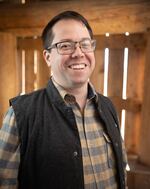
Project officials received positive feedback and permission from the tribes to move ahead. The project came to a standstill during the pandemic, but last winter Dave Eckert, a member of the Marys Peak Alliance who was involved in the naming effort, asked the city of Corvallis about putting up signs to mark the creeks.

Dave Eckert, a member of the Marys Peak Alliance, talks about the creek naming process on July 16, 2025.
Zoie Stayton and Felix Locker / High School Journalism Institute
The city agreed and paid to install the signs in May.
“It was shocking to me because any bureaucracy you work with anywhere, something doesn’t just happen,” Eckert said. “And this just happened.”
The Kalapuya people call Marys Peak “tcha Timanwi,” which means “place of spiritual power.” It’s among the places where they hunted, fished and gathered other food.
Officials named 10 creeks in the Marys Peak area as part of the project. Six on the east side of the mountain — traditionally the land of the Marys River Kalapuya, now a part of the Confederated Tribes of Grand Ronde — were given Kalapuya names.
Undated photo of David Harrelson, cultural resources manager for the Confederated Tribes of Grand Ronde.
Courtesy of David Harrelson
The four creeks in the Rock Creek watershed have Kalapuya names due to the land they flow through.
“There’s a very strong, positive feeling about getting the names of animals and as they were known to our ancestors back on the landscape,” Harrelson said. “It’s very meaningful to see Kalapuya words presented to the public and be a part of placekeeping.”
The remaining four creeks, on the west side of the mountain, were given Wusi’n and Yaqo’n names by the Confederated Tribes of Siletz Indians.
Public access to the Corvallis-owned portion of the watershed, which produces one-third of Corvallis’ water, is restricted except for an annual public tour.
“It’s part of the city’s critical infrastructure, so it has rules and regulations it has to follow,” said Patrick Rollens, a spokesperson for the Corvallis city government.
While the signs in the Corvallis Forest and additional signs planned for the creeks on the peak’s west side in the Siuslaw National Forest are simple, bearing only the creek’s name, Harrelson hopes that might spur people to seek out information.
“I hope that it’s almost like an Easter egg or it’s a little tickler for people to get curious,” he said, “because there’s a whole literature of traditional stories that relate to these characters and these stories.”
Related: Sauvie Island Bridge north of Portland renamed to honor Indigenous tribes
Julia Cline, a Water Conservation Program specialist who frequently works in the area, said that it was great to see the city and tribes working together. City officials made sure the signs were placed before this year’s tour to allow members of the public to see them.
“It shows that the city puts its work where its mouth is,” Cline said.
It began as a simple idea, but the result of the collaboration, Eckert said, will be not only actions, but education.
“What’s in the name?” he said. “It’s a lot. A lot. A lot is in the name.”
This story was produced by student reporters as part of the High School Journalism Institute, an annual collaboration among The Oregonian, Oregon Public Broadcasting, Oregon State University and other Oregon media organizations. For more information or to support the program, go to oregonhsji.org.
This republished story is part of OPB’s broader effort to ensure that everyone in our region has access to quality journalism that informs, entertains and enriches their lives. To learn more, visit opb.org/partnerships.