A storm is making its way across northwest Oregon and Southwest Washington Wednesday afternoon, with potential thunderstorms and heavy rain on the way.
That’s according to the National Weather Service, which issued a Special Weather Statement this morning.
T-storms are possible west of the Cascades Wed afternoon and evening, a few of which may produce damaging wind gusts. There are also low chances of a weak tornado or waterspout (see dark green area). Heavy showers may also have gusty winds, small hail, and lightning. #orwx #wawx pic.twitter.com/NwKuvAE25P
— NWS Portland (@NWSPortland) November 4, 2025
Forecasters say some areas could see damaging winds up to 60 miles per hour and possibly a brief, weak tornado or funnel cloud.
The chances for afternoon thunderstorms are slightly higher for the Oregon Coast at about 25% while areas west of the Cascades, including the Willamette Valley, are at about 15%.
According to the NWS Area Forecast Discussion, there’s also a low chance of a tornado, about 2%, making its way onshore. If a tornado warning is issued, meteorologists urge people to get to the lowest, most interior room of their home and away from windows and exterior walls.
Active weather continues today. Stronger thunderstorms/showers could produce wind gusts up to 60 mph, funnel clouds or possibly a brief tornado. Know what to do IF a Severe Thunderstorm Warning or Tornado Warning is issued for your area. #orwx #wawx pic.twitter.com/H1WTqpc4nz
— NWS Portland (@NWSPortland) November 5, 2025
If you are outdoors, the NWS suggests finding shelter in a ditch or culvert and covering your head. Officials warn to never go under an overpass during high winds or a tornado.
Forecasters say lightning and small hail are also possible through Wednesday evening.
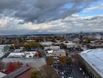
A view of Portland from the top of an apartment building in Goose Hollow on Nov. 5, 2025.
Francisca Benitez / OPB