
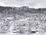
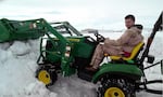
Snow covers the fields and the cows on Katherine Cory's farm in Troutdale on Wednesday, Jan. 11, 2017.
Katherine Cory

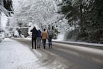
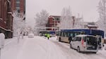


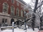

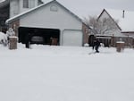

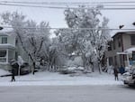


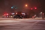


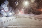

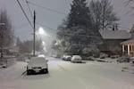

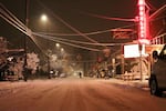


It was a historic evening for Portland and surrounding areas Tuesday night as record snowfall led to one of the snowiest days ever recorded at the Portland International Airport.
Related: Cold Temperatures Settle In As Oregon Tries To Clear Out From Record Snowfall
By 5 a.m. Wednesday morning, the National Weather Service said it recorded 6.5 inches at their offices near the airport.
“That makes this the ninth snowiest calendar day at PDX since 1940,” said Colby Neuman, a meteorologist with the NWS in Portland. The agency also described it as the snowiest day in the Portland and Vancouver area since Jan. 20, 2008.
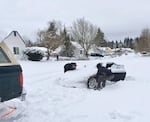
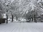
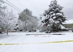
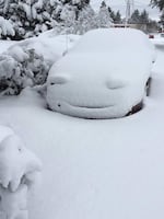
Elsewhere, the snowfall was much heavier. On average, the city and surrounding communities received 8-12 inches of snow Tuesday evening into Wednesday morning.
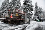
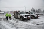
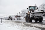
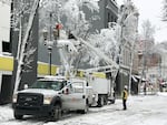
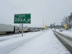
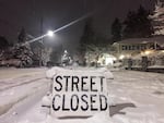
The Oregon Department of Transportation said chains are required for all vehicles traveling on Portland metro area highways Wednesday morning, and advise people to stay home if they can.
ODOT is currently bringing trucks and other snow removal equipment from around the state into the Portland area to help clear roads.
"That's our strategy for the Portland area, try to get this snow off the road, get some sand down, that's going to be a big help," said Don Hamilton, a spokesman with the agency.
Portland police said, much like a storm that came quickly upon the region in December, many people had difficulty traveling Tuesday night.
“The reports are that there were hundreds of cars abandoned on the highways and dozens, if not hundreds of people stranded in their vehicles," said Portland Police Sgt. Christopher Burley.
Officers assisted by transporting some people to the central precinct. They continued to check on cars throughout the morning, as weather allowed, Burley said.
We are already starting to be concerned about flooding. All this snow and at least hints of an atmospheric river. Stay tuned! https://t.co/UXpOcXCDwf
— NWS Portland (@NWSPortland) January 11, 2017
The heavy snowfall has also left more than 37,000 Portland General Electric customers without power. That number was down to just under 30,000 customers by 11 a.m. Wednesday morning. Clackamas County was hit the hardest with more than 18,000 customers without power, while more than 12,000 are without power in Multnomah County. Clark County, Washington had about 15,000 people without power, but as of midday Wednesday Clark Public Utilities had restored all but about 400 customers.
Hard at work today to restore power to customers affected by outages. Stay safe, avoid downed power lines! Info on https://t.co/IQ19l0Itbh.
— Portland General (@portlandgeneral) January 11, 2017
The NWS had a tough time just keeping up with the changing forecast as the snow fell late Tuesday, said fellow meteorologist Clinton Rockey.
“What we saw across the region was a nightmare unfolding for the area. Snowfalls in the metro area, boy I tell you, it was really a lot of fun for us to figure out what’s going on," he said.
The metro region saw the unusual phenomenon of what’s known as “thundersnow.” Which is what it sounds like: a thunderstorm during a snowstorm.
“You get very unstable air above us, and we had those thunderstorms there, but because it's so cold underneath down here in the lowlands, the snow that was falling at them was coming down at a much heavier rate," Rockey said. "If you were outside and got to see it, it’s quite a treat."
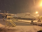
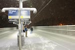
The Portland International Airport was closed for two hours late Tuesday night as crews worked to clear a runway during the heaviest snowfall, said Kama Simonds, a spokeswoman with the Port of Portland.
The north runway was closed, but Simonds expected it to open around 6 p.m. Wednesday. Ground crews spent the day working to keep the south runway open, she said. Despite one runway being shutdown, Simonds said there were no capacity issues.
About 120 flights were canceled Wednesday and there were a number of delays, but airlines were operating flights.
About 1,000 people spent Tuesday night at PDX, she said.
"If you think that you have a flight going out today, check with your airline and then give yourself plenty of time to proceed to the airport," Simonds said. "They continue to plow and treat the surfaces."
The last time the Portland airport had all it's runways shut down was during an ice storm in 2004.
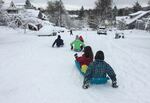
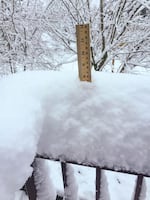
Some surrounding areas in the Portland metro area received significantly more snowfall than others, with Beaverton, the West Hills, Vancouver and areas of southwest Washington up to Salmon Creek receiving on average between 10-12 inches of snow. In North Portland, the NWS recorded 13 inches of snow at 3 a.m Wednesday.
Over a foot of snow in the west hills. 14.5" storm total. https://t.co/S7g4ze6HfE
— NWS Portland (@NWSPortland) January 11, 2017
But areas south of Portland fared much better in regards to the historic snowfall, with Tualatin, West Linn and Oregon City receiving around 3-6 inches of snow. As much as 3 inches of snowfall is in the high hills surrounding Salem, with only about 1-2 inches in the city proper.
“There’s a pretty sharp line between the haves and the have-nots” when it comes to snowfall, Neuman said.
Eugene has been hit fairly hard this winter with snow and ice but escaped last night relatively unscathed with no official reports of snow, according to the NWS. Corvallis was getting reports of snow sticking to the grass late Tuesday night, but nothing was sticking to roads or sidewalks by midnight last night, Neuman said.
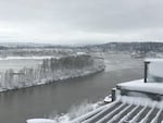
In the Columbia River Gorge, Hood River received an additional 3-4 inches of snow overnight, bringing their total to 10 inches of snowfall since Tuesday. Interstate 84 from Troutdale to Hood River was at one point closed to all traffic.
Interstate 84 is now open through the Columbia River Gorge between Troutdale and Hood River.
— OregonDOT (@OregonDOT) January 11, 2017
Hamilton, the ODOT spokesman, said the hardest hit part of the state right now is the Columbia River Gorge.
“The Gorge always gets hit by a little bit of everything when we get a storm like this," he said. "They’ve been hammered by ice last week. They never really recovered from the ice storm when the snow hit. So they got a lot of snow on top of ice.”
On Wednesday, Clark County Public Works said it had 30 pieces of road clearing equipment in the field. The agency said major thoroughfares had been cleared, but "still have significant snowpack" and that travel is most difficult on residential streets. ODOT said it had about 100 pieces of snow clearing equipment at its disposal in the Portland metro area.
State agencies in Clackamas, Columbia, Gilliam, Hood River, Multnomah, Sherman, Wasco, Washington, Wheeler all announced closures early Wednesday. Crook, Deschutes and Jefferson counties said they would open around 10 a.m.
And the snow isn't done. For much of the Willamette Valley north of Salem, accumulation will continue.
“We’re expecting 1-4 inches of snow, mainly this morning,” Neuman said. “It won’t be nearly as intense as we saw last night.”
But with temperatures expected to stay at or below freezing for the region through the end of the week, he added that a big melt won't happen anytime soon.
“What you see now is what you’ll have through the end of the week," Neuman said.