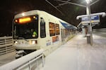
An Orange Line MAX train departs the Southeast Bybee Boulevard station toward Milwaukie in Portland's Sellwood neighborhood during a snow storm on Wednesday, Jan. 11, 2017.
Bradley W. Parks / OPB
The Portland metro area could see as much as 4 inches of snow by Sunday evening, according to the National Weather Service.
Temperatures are expected to drop below freezing Sunday afternoon, turning the heavy precipitation into a blanket of thick, wet snow, according to the NWS.
“We’re already seeing snow mixing in with rain at many places across the Portland area,” Laurel McCoy, a meteorologist with the NWS said Sunday morning.
“Still the amount is the big question. Right now we’re calling for 1-4 inches, with lesser amounts on the southeast side. But we could still certainly see more if we can get the snow to start sticking here earlier in the day.”
The Willamette Valley is under a winter storm watch from 10 a.m. Sunday through 6 a.m. Monday.
PDX Metro area expectations: Rain/Snow mix to all snow in the next few hours. Struggle to stick to roads until later in afternoon/evening.
— NWS Portland (@NWSPortland) February 5, 2017
The Portland metro area, Coastal Range, North Coast and Columbia River Gorge are all expected to get several inches of snow during that time period. But warmer temperatures south of Portland mean Salem and surrounding areas will just see rain. The Southern Washington Cascades could see as much as 2 feet of snow.
But the NWS is having trouble nailing down more specific predictions due to the unusual nature of this storm. According to McCoy, the problem is the cold air is moving in from the Gorge, like it normally would. Instead it's coming in from above.
"It's really hard to track how fast that process is occurring without actually seeing it."
The good news is temperatures are expected to rise overnight and turn that snow back into rain. Roads should be slushy in time for the Monday morning commute, but passable.
Portland unveiled a new snow plan on Feb. 1 promising more plows on more streets, and upping the city’s use of salt to melt ice.
Rain snow mix doing its work. Temperatures dropped from 40-42 at 8am to mid 30s at 11am. will continue to fall. pic.twitter.com/KsB1QU5WZL
— NWS Portland (@NWSPortland) February 5, 2017
“We’re still learning how to deal with major winter weather events in Portland,” said Portland Transportation Commissioner Dan Saltzman at a press conference announcing the snow plan.
Related: Portland Promises More Plows, Salt For Next Winter Storm
Portland Bureau of Transportation spokesperson John Brady said the bureau will begin winter weather operations around noon Sunday. If the snow hits, a staff of about 150 people will work around the clock to plow and de-ice roads.
"If we get the many many inches of snow in the worst possible forecast, it will certainly be a test [of the new snow plan]," Brady said.
PBOT salted select areas throughout the city during an ice storm Friday. Brady said the bureau's use of salt was "effective."
Portland’s most recent snowstorm blanketed the city in a foot of snow in some places. A bitter cold snap kept snow and ice on city streets for more than a week after the last snowflake fell, handcuffing many motorists and closing area schools for several days.
In mid-December, a winter storm paralyzed Portland traffic, stranding many children at schools and even more motorists on highways — forcing some to abandon their vehicles.
“This is obviously going to be a winter that gets remembered for a long time,” said Bryant with the NWS. “To some degree, a lot of us [at the NWS] enjoy the forecast challenge. But like a lot of people in Portland, we’re kind of ready for a change of season.”
Bryant said this weekend’s weather system is something the Weather Service has seen only a few times in the last two decades.
A similar system broke decades-old snowfall records in Eugene in 2012.
PBOT advises those traveling Sunday — especially to and from Super Bowl parties — to avoid driving and use public transportation if possible.