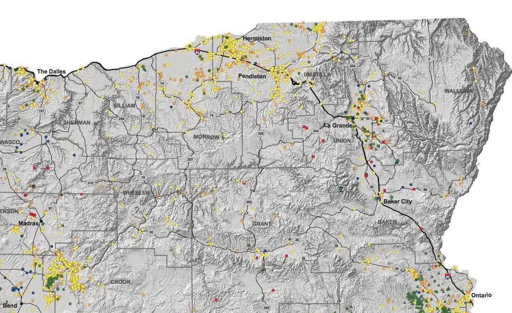
A new map shows geothermal energy resources across Oregon.
Oregon Department of Geology and Mineral Industries
The Oregon Department of Geology and Mineral Industries has published a new map showing hot springs, volcanic vents, test wells, and other geothermal resources across the state.
Naturally occurring hot water and steam found mostly in volcanic parts of the West can be used to heat homes and generate electricity.
Clark Niewendorp, who developed the map, says existing geothermal technology requires hot water that’s between 70 and 90 degrees Celsius (or between 158 and 194 degrees Fahrenheit) for commercial power generation.
(A higher resolution of the map can be downloaded here.)
Oregon is one of just eight states currently generating electricity using geothermal energy: in Vale, a company operates a 26-megawatt commercial geothermal power plant at Neal Hot Springs. The town of Klamath Falls uses geothermal energy to warm its sidewalks, and the Oregon Institute of Technology operates a small geothermal power plant.
Of course, the best known geothermal project in the state is a
Niewendorp says the Oregon Department of Geology is planning to drill several thousand-foot deep test wells this spring to search for potential geothermal resources near Silver Lake and Christmas Valley in Central Oregon, and on the east side of the Steens in Malheur County.