
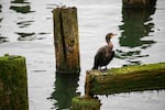
A double-crested cormorant rests on pilings along the Astoria waterfront, Astoria, Ore., Aug 10, 2024.
Anna Lueck / OPB
From acidic excrement that eats through bridge coating, to nesting near roadways and causing accidents, cormorants have been known to create some problems for humans here in Oregon. But for more than a decade now, researchers at Oregon State University have been using these diving creatures to better understand oceans in Oregon and around the world. By strapping sensors to birds, researchers are able to chart and understand data around underwater terrains, temperatures and more. Rachael Orben is an assistant professor at OSU’s Department of Fisheries, Wildlife and Conservation. Jim Lerczak is the associate dean for Research and a professor at OSU’s College of Earth Ocean and Atmospheric Sciences. They both join us to share more on what we’ve been able to learn from these diving birds.
Note: The following transcript was transcribed digitally and validated for accuracy, readability and formatting by an OPB volunteer.
Dave Miller: From the Gert Boyle Studio at OPB, this is Think Out Loud. I’m Dave Miller. As we’ve talked about in the past, cormorants can cause headaches for Oregonians. Acidic excrement from these marine birds can eat through bridge coatings, and wildlife biologists have said that they’re eating too many endangered salmon and steelhead. But for more than a decade now, researchers at Oregon State University have been putting these birds to work. They have strapped small sensors on cormorants’ backs all over the world as a way to collect data about underwater terrain, temperature and more.
Rachael Orben is an assistant professor at OSU’s Department of Fisheries, Wildlife and Conservation. Jim Lerczak is the associate dean for research and a professor at OSU’s College of Earth, Ocean and Atmospheric Sciences. They both join me now. It’s great to have both of you on the show.
Jim Lerczak: Thank you.
Rachael Orben: Thanks for having us.
Miller: Rachael, first – I mentioned that this work is being done all around the world. How much variation is there among cormorant species?
Orben: There’s a huge amount of variation among cormorant species. There’re cormorants in tropical places, also in high latitudes like the Arctic or the Antarctic. And some species, like the Brandt’s cormorant in Oregon, are marine species. They’re obligate to forage in the ocean and other species can forage in freshwater environments as well.
Miller: What makes these birds good candidates for this kind of research?
Orben: Most cormorants spend their entire lives really close to the coast, so they’re foraging in our complex habitat along the coast. They have to work hard to make a living. They do have to dive many times, about 100 times a day or more, to catch the fish that they need. So they can provide us really good information on the health of our coastal ecosystems.
Miller: And when they dive, how far down might they go?
Orben: It depends. The larger species, for example the Brandt’s cormorant, we’ve documented diving up to 80 meters. But for smaller species, a lot of these birds are really not going that deep. They might be just going 10 meters or less.
Miller: But 80 meters, over 200 feet down … It seems so unfair. They can fly and they can swim, essentially?
Orben: And they have to actually paddle with their feet to get that deep, so they’re kicking to get down.
Miller: I want to hear more about how you actually get these sensors, these little backpacks on these birds.
But Jim, what kind of data is being collected from cormorants or related species all around the world?
Lerczak: An exciting part of this project for me was thinking about how we can put sensors, that we typically make measurements in the ocean from big ships, and miniaturize those sensors to get them in a package that can be handled by a cormorant. Some of these sensors include temperature. It’s just a basic measurement that’s really important to make in ocean regions. We have a sensor for measuring how salty the water is, salinity, measuring how deep the cormorants go, and also an accelerometer, similar to the sensors on a cell phone to measure really precise motions of the birds. We also include a GPS so we know where they are when they’re making dives. And we have solar cells on them so that the batteries remain charged for long periods of time. Then we have a cell phone to talk to the birds, to program the tags and get the data back.
Miller: So not to talk exactly to the birds, but to talk to the sensors that the birds are carrying?
Lerczak: That’s correct, yes.
Miller: Unless I’m mistaken, just hearing the variety of bits of data you can collect from these sensors, that falls into two different buckets. One is about a bird’s behavior, what these birds are doing. The other is about the natural conditions in their environments. Is that right?
Lerczak: That’s correct, yeah, absolutely. The data is very rich for studying bird behavior. But it’s also very rich for telling us about the environment, telling us, as I said, about temperature and the salinity of the ocean. But we’re also using the data and analyzing it in sophisticated ways to tell us how fast the currents are going at the surface. Using these accelerometers tells us, when the birds are at the surface, how big the waves are. So it’s basic data but also processing the data to get information like currents and waves.
Miller: You’d mentioned that another alternative to using these sensors on birds would be to affix them to ships. I imagine you could also use drones of different kinds. In the past we’ve heard about LiDAR [Light Detection and Ranging] for assessing and mapping out different parts of the physical world. What can you do with these birds that you can’t do with those other technologies?
Lerczak: Well, you’re right. Those are using remotely operated vehicles [ROVs], using ships. Those are major tools that oceanographers use to measure the ocean. Birds allow us another tool, along with these more traditional methods. Birds are out there every day making measurements. As Rachel said, they make about 100 profiles a day. We’ve had tags on an individual bird for longer than a year. So they’re making measurements for long periods of time and also going to regions that are challenging to get to by other methods, by remotely operated vehicles and ships, such as really close to the coast – regions where it’s rocky, wavy and dangerous to get to with a boat and also really shallow regions which are hard to navigate with ROVs or ships. So it allows us to get into areas that are more challenging from other methods of making measurements.
Miller: Rachael, what’s the process like to actually put these little backpacks on these birds?
Orben: It really depends. So there’s a wide range of cormorant species all over the world and they have different perceptions of humans. How easy it is for us to approach them and to capture them really depends. So in the southern hemisphere, people can capture birds, say in Peru, by using a blind and access the colony, and, not quite pick up birds, but at least get to choose birds when they’re tending a nest.
But, for instance, in Oregon we’ve caught birds away from colonies using nets and really targeted capture options. Cormorants are pretty smart and that’s another reason why we like to put tags on them. They know where the important areas of our coastal ocean are. They know where to find food and what places really matter to them.
Miller: Jim, what more do you want to learn? As I noted, this has been going on for a while now, using a number of different species all over the world. What are examples of what you still are hoping to learn?
Lerczak: One of the great things about getting data from birds is that we get a lot of data. I think, today, we have on the order of 5 million profiles that were obtained from diving birds. One of the challenges, unlike traditional methods where you go where you want to go and you design an experiment to study a particular phenomenon, is that with bird data, the birds go where they want to go. So it makes it a little more of a challenge to analyze this data.
So where we’re going with this data is to combine it with modeling data and use the bird data to refine models of the regions where we’re making measurements. For example, the Columbia River Estuary. We also have a big project in the Persian Gulf where we’re using bird data combined with models, combined with satellite data to understand what controls temperature within the Persian Gulf and how that varies, for example, when dust storms happen in that region. So really it’s learning how to combine this type of data with models and other types of measurements, like satellite data, to compliment each other and learn more about a particular region.
Miller: Jim Lerczak and Rachael Orben, thanks very much.
Orben: Thank you.
Lerczak: You’re welcome. Thanks for having us.
Miller: Jim Lerczak is the associate dean for research and a professor at OSU’s College of Earth, Ocean and Atmospheric Sciences. Rachael Orben is an assistant professor in the Department of Fisheries, Wildlife and Conservation at OSU.
“Think Out Loud®” broadcasts live at noon every day and rebroadcasts at 8 p.m.
Contact “Think Out Loud®”If you’d like to comment on any of the topics in this show or suggest a topic of your own, please get in touch with us on Facebook, send an email to thinkoutloud@opb.org, or you can leave a voicemail for us at 503-293-1983. The call-in phone number during the noon hour is 888-665-5865.