
After Oregon’s devastating 2020 Labor Day fires, the Legislature passed a bill that was supposed to lead to more wildfire awareness and resilience. Among other things, Senate Bill 762 created a map of areas at high risk of fire.
But that map led to a huge backlash from property owners — a backlash so strong that a few weeks ago, the state Senate voted unanimously to eliminate it.

FILE - Democratic Senator Jeff Golden, at the Oregon state Capitol, Monday, Feb. 5, 2024, in Salem, Ore.
Kristyna Wentz-Graff / OPB
Jeff Golden is a Democratic state senator from the Rogue Valley. He voted to create the map in 2021, now he’s voted to get rid of it. Golden joined OPB’s “Think Out Loud” on Tuesday to talk about both of those votes.
Push play to listen: Oregon state Senator Jeff Golden discusses Oregon’s history with mapping wildfire risk with OPB “Think Out Loud” host Dave Miller.
Here are highlights from their conversation.
Why Oregon lawmakers commissioned a wildfire map
It started with an effort to minimize and respond to wildfires in Oregon by learning from the most successful efforts across the U.S. and the world, Golden said. Former Gov. Kate Brown convened the Wildfire Response Council as a temporary study group to propose policies Oregon could adopt.
“One of their 37 recommendations was a map to guide deployment of resources, so we put it in,” Golden said. It was part of SB 762, an omnibus bill that was largely based on the study group’s recommendations.
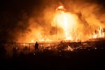
FILE - The Labor Day fires of 2020 sparked legislation a year later requiring Oregon to create a wildfire risk map. Now some of the proponents of that map think it should be repealed.
Courtesy of U.S. Forest Service / Courtesy of U.S. Forest Service
“We delegated to Oregon State University, which has credentials — among the best in the world in terms of maps like this — and gave them almost no direction, just said, ‘We need a map to fulfill this purpose. Let us have it within the next 18 months.’”
At the time, very few lawmakers were worried about what would come next.
The backlash – and 3 of its causes
Almost immediately after the state released its wildfire map, people in rural areas of Oregon began to criticize it. Looking back, Golden said he sees three roots of that backlash.
1. Misinformation
When the map was first released, it designated broad regions of the state as low, moderate and high hazard.
“And there was misinformation we could not get out in front of,” Golden said. Rumors spread that state regulations would require homeowners in high hazard areas to clear grass, brush and trees within 100 foot radius of their house — “If you are high hazard, you are cooked, because the state’s going to be out insisting you remove every blade of grass,” the rumors went. “So there was this perception that being high hazard would be a disaster.”
2. Insurance hikes and bad timing
“The first map that rolled out, its first draft in 2022, came out exactly as people were starting to get this avalanche of notices from their insurance companies that their premium was going up, or they’d be canceled or non-renewed,” Golden said. It was a coincidence “that happened at exactly the same time, which joined the map and the insurance problems in people’s minds forever.”
3. The map was too broad
But the biggest issue, Golden said, was that the map only factored in broad landscape characteristics without looking at the on-the-ground details of private property. A region might be deemed hazardous based on weather, topography and vegetation across multiple large-scale parcels, even when individual property owners within that region took extreme care to mitigate the risk of fires.
“This model had no room whatsoever for anything specific to the property, yet it went ahead and assigned a hazard designation of that property,” Golden said.
“It just doesn’t matter, not 1% in this formula, what you’ve done to your property,” he said. “And that was just asking people to accept too much, and really deeply undermining the program and people’s interest in collaborating for a safer Oregon. I really saw no choice other than withdrawing these maps.”
What comes next, and an invitation to insurers
The controversy over Oregon’s wildfire map has taught lawmakers a major lesson about what works and what does not work in rural areas, Golden said.
People want to be safe and to mitigate fire risk on their property, he said. “But in this environment, forceful regulation of rural residents isn’t going to work anywhere, even if the map made more sense.”
He now backs Senate Bill 85, which passed in the state Senate and will get a hearing in the House climate committee on Thursday. SB 85 directs state agencies to consult with the insurance sector to recommend ways to reduce wildfire risks.
If laws requiring people to protect their homes and clear brush are a stick that rural Oregonians have fought against, the insurance industry may have carrots that are more effective – like lower rates for policyholders who work to minimize fire risk on their properties.
One area where Oregon public officials, like the insurance commissioner and fire marshal, can lead: developing standards for homeowners to follow – especially if the insurance industry then assures people that their rates will be affordable if they follow those standards, Golden said.
“Now that’s the goal,” he said. “I’m not at all sure we can 100% achieve it, because the conditions out there are so severe.”
But as lawmakers continue to learn, he said he hopes this next step in the dynamic worlds of politics and wildfires will help rural Oregonians find a path to policies that they can support.