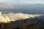
Heavy smoke rolls off of a wildfire burning in Central Oregon, July 27, 2026. The record-breaking fire season, which is not over yet, has burned 2.5 million acres statewide.
Sarah Nairalez / OPB
Large and super-hot wildfires have been increasing as global temperatures rise. So too have the phenomena they create: “pyrocumulonimbus clouds,” better known by their informal, easier-to-pronounce name, “fire clouds.”
Large fires push air and particulates into the higher atmosphere where they can form thunderclouds that can produce electrical storms and tornadoes. The wind and lightning expand the large fires they were generated from.
But this summer, NASA launched a new project collecting data on fire clouds using a modified U2 spy plane, including fires in Central Oregon.
We learn more from Dr. David Peterson, an atmospheric scientist at the US Naval Research Laboratory in Monterey, CA, and the principal investigator.
Note: The following transcript was transcribed digitally and validated for accuracy, readability and formatting by an OPB volunteer.
Jenn Chávez: This is Think Out Loud on OPB and KLCC. I’m Jenn Chávez, in today for Dave Miller. As climate change creates warmer, drier conditions in the West, extreme super-hot wildfires are becoming more common. In Oregon this year, around 2.5 million acres have burned in a record-setting fire season.
That caught the attention of a NASA research team that’s been studying a phenomenon called “pyrocumulonimbus clouds,” also known as “fire clouds.” These occur when intensely hot wildfires push air and smoke higher into the atmosphere, essentially creating their own weather systems. This summer, a team of scientists has been collecting data on these clouds by jet, including here in Oregon, to better understand how they work.
David Peterson is the research mission’s principal investigator. He’s an atmospheric scientist at the U.S. Naval Research Laboratory in Monterey, California, and he joins me now to talk more. David Peterson, thank you so much for being here to talk about what you’ve been learning.
David Peterson: And thanks for having me. It’s great to be here.
Chávez: So, let’s start with the very, very basics here. I tried to lay them out just now in my introduction to our conversation. But for our listeners who are hearing about this phenomenon for the first time right now, what are fire clouds? How would you explain what they are?
Peterson: So the INSPYRE mission that you mentioned is after a phenomenon where wildfire basically generates its own thunderstorm, if you will. So you can imagine wildfires generate considerable amounts of heat. That warm air rises like a bubble in the atmosphere. And under certain conditions, that rising bubble can encounter a layer of the atmosphere that has some moisture and instability that allows it to generate a cloud. And then there are certain conditions that can keep growing even larger until you have this full-scale thunderstorm that is fed directly by the heating from the wildfire. So that’s what we call pyrocumulonimbus, or pyroCb for short.
Chávez: And you are speaking a little bit to this – this is creating a thundercloud, thunderstorm-like conditions. What specific type of weather or weather patterns can these clouds create after they form?
Peterson: Well, imagine that you’re at a large wildfire and there’s this huge smoke plume being pushed up into the atmosphere. And then if you generate a thunderstorm on top of that, if you’re near the fire, it creates this very hazardous environment where it’s dark, smoke-filled. Think of the dirtiest clouds on earth. But also, that thunderstorm is accelerating air upward in the atmosphere, so the air around the wildfire is coming in to take its place, and you create this sort of erratic wind behavior near the fire. It can affect fire spread. It can make it very dangerous for the firefighting effort. There are even situations where these fire-generated storms have produced their own tornadoes. And they can generate lightning, so in some situations, the fire-generated storm is igniting new fires downwind by its own lightning strikes.
So that’s what’s going on near the fire. But these storms also act as giant chimneys in the atmosphere, so they’re funneling smoke upward into that thunderstorm updraft and ejecting it at the top of the cloud. And oftentimes that’s jet aircraft cruising altitude or higher. So in that situation, it’s more or less like the fire is generating this volcano-like effect and pushing smoke high into the atmosphere.
So the experiment we’re conducting is really after these two pieces. What’s going on near the ground where the fire is generating its own weather, and how does that project through the atmosphere? And then once you get these really large plumes at high altitudes, what’s that doing to downstream weather?
Chávez: So, the NASA research mission you’ve been leading, this INSPYRE mission, is being conducted, at least in part, by jet. What kind of information has your team been gathering from these flights over, or as I understand it, sometimes also through these clouds?
Peterson: That’s right. So we actually have two aircraft as part of the mission. Where I’m located now in Montana, we have an aircraft owned by NASA that’s called the ER-2. And this flies very high in the atmosphere, we’re talking 65,000 feet. And we use this as kind of a steerable satellite that we can move above the fires. We often move it back and forth rapidly, so we can get a sense of how the fire is behaving in the landscape. How is the heat changing over short time intervals, how is the fire spreading? And then how does that relate to the behavior of the smoke plume? And in the cases where we do get fire-generated clouds, how rapidly are they growing? How is the air motion within them? And ultimately, when it does produce a full thunderstorm, what does that upper part of the cloud look like cause we’re flying high above that. You can kind of think of that as just moving around a satellite, if you will.
The other aircraft we have available, it’s owned by NCAR and the National Science Foundation. That’s a Gulfstream V. So that’s more like a small passenger jet, if you will. And that plane has the ability to pull outside air into instruments, so it can directly sample the air near the storm. And this is the plane that will actually fly through the upper portions of these fire-generated clouds. I’ve been on a few of these flights where we’re actually flying directly through the tops of the clouds, measuring how the smoke is changing as it’s pushed through the cloud, and then ultimately as it moves downwind, how the smoke is evolving.
So, really the mission requires both of these aircraft to be working in tandem. Basically, a high flying plane over this plane that’s flying directly into the clouds to get the full picture.
Chávez: You mentioned that you’ve been on one of these planes as it’s gone through one of these clouds. What was that experience like? Because when I read that folks were doing that, that sounded really intense. What was the experience like for you?
Peterson: You can kind of think of this experiment as a well-organized storm chase. We’re basically chasing storms with aircraft over wildfires. When you’re on a plane up close to this, it’s kind of unworldly. As I mentioned, these are thunderstorm-type clouds, but they’re filled with smoke. So if you make a pass through the tops of this, you can imagine if you’re on a commercial jet flying through a typical puffy cumulus cloud, imagine that being filled with smoke. It’s dark inside. It almost has an orange appearance. And with some of the bigger clouds, you’ll actually get a whiff of smoke on board the plane as you go through it because it’s just very, very filled with smoke. As I said, it’s like a giant chimney.
Chávez: Wow. I know this mission’s first flight, if I’m not mistaken, happened here in Oregon. What were the conditions like here that made Oregon and its wildfires this summer a good candidate for study?
Peterson: The mission actually began in late July. And around that time, Oregon was kind of at the peak of this really severe fire season. There were already a large number of fires ongoing in the state, and there had been several periods of large pyrocumulus events that had already occurred. We flew out to that area knowing that there would be multiple active fires at the start of the mission to test all of our components. So we had the ER-2, the Gulfstream V, also our ground team, all located … At the time, it was called the Brewer Complex and the Bench Complex fires, basically south Central Oregon.
So that’s where we kicked off the experiment, we tested everything. Those fires did produce some smaller fire-generated clouds. But on that day, it didn’t generate the full-scale thunderstorm.
Chávez: Now that you’ve collected data from different locations – Oregon is not the only place where you surveyed and collected information since this mission started earlier this summer – what happens next? What are you looking for when reviewing or comparing this data, and what are you hoping to learn?
Peterson: We actually begin evaluating the data immediately in the field. As soon as flights end, if it’s a day we’re not flying, we do science team meetings in the field to get an initial look at the data, see what’s working well, what things we may need to change. And now that the mission is wrapping up for this year, we’ll go into more detailed scientific analyses. We’ll be looking at data from all of our platforms to understand, how hot do fires have to be to generate these clouds? What is the behavior of the fire at that time? How is the atmosphere behaving in situations where we get large pyrocumulonimbus, and situations where we don’t?
And then we have a whole team that’s sort of oriented in the forecasting part of this. I think a big thing to remember is that these fire-generated clouds are not well forecast. They basically represent a gap in all of our weather forecasts. So especially when you get these large smoke plumes high in the atmosphere moving downwind, we are working to understand how that may change the temperature profile of the atmosphere. Sometimes the smoke can absorb the solar radiation and create a heating effect where the smoke’s located, but also, at the same time, cooling the layer near the ground. That effect on weather is not included in any of the forecast models.
So we’re going to be working to not only fundamentally understand how this process develops and how we get these storms, but also better predict this type of fire behavior, not only for the firefighting effort, but also what this might mean for weather hundreds or even thousands of miles downwind.
Chávez: So a main goal is to be able to better predict when this type of fire behavior might occur. Do you see any possibility down the line of this kind of research enabling firefighters or others working to address these fires to take steps to actually mitigate the conditions, mitigate the impacts of these fire clouds? So not just predict them but be able to do something about them?
Peterson: Well, what I can say is we have members of our team who are directly engaged with the firefighting efforts, so there is some stakeholder involvement here. We communicate directly with what are called incident meteorologists on the ground near these fires. During the experiment, it’s to understand a bit about the fires that we’re planning to go out and sample. But also, the members of our team who are building prediction products are engaged with them to test. We’re using this entire experiment as a test bed for various prediction tools. So that much we can do.
In terms of mitigation, it’s just basically, how can we better position the firefighter to handle these situations where the fire starts generating its own weather? And more or less, that’s helping keep them away from the hazards, but being able to fight the fire in situations prior to or after that occurs.
Chávez: Well, David Peterson, thank you so much for joining us today to share a little bit about the important research that you and your colleagues have been doing in Oregon and across the country.
Peterson: Yes, thanks so much for having me.
Chávez: David Peterson is the principal investigator of NASA’s research mission studying pyrocumulonimbus clouds, called the INSPYRE mission. He’s an atmospheric scientist at the U.S. Naval Research Laboratory in Monterey California.
“Think Out Loud®” broadcasts live at noon every day and rebroadcasts at 8 p.m.
If you’d like to comment on any of the topics in this show or suggest a topic of your own, please get in touch with us on Facebook, send an email to thinkoutloud@opb.org, or you can leave a voicemail for us at 503-293-1983.