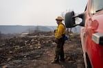
Oregon State Fire Marshall structure protection task force lieutenant Ray Dandeneau keeps a look out as his crew works to protect a home from hot spots burning around it in the Bench Fire off of Highway 26 between Warm Springs and Madras, Ore., on July 28, 2026.
Eli Imadali / OPB
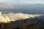

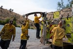

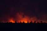
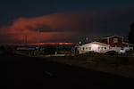
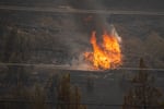
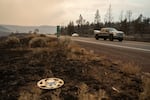
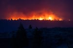
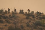
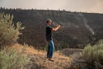
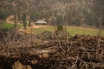
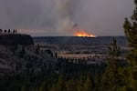

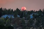

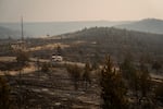
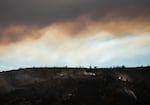
At least 6,000 people in Oregon were under Level 3 “Go Now!” evacuation orders as of Tuesday evening as dozens of active, large fires covered more than 1.5 million acres, according to the Oregon Department of Forestry.
Hot, dry weather and strong winds have fueled the wildfires since the weekend and burned several homes.
Lightning storms sparked many of the wildfires, and more could be on the way. Forecasters expect another round of lightning in northeastern Oregon Thursday afternoon.
Update: 4 p.m. Tuesday, July 28
The Oregon National Guard has stepped up its wildfire response as dozens of fires stretch resources around the state.
The guard announced Tuesday it will activate four helicopters and “approximately 20” servicemembers to battle the Hagen Fire burning in Eastern Oregon, near the Umatilla Indian Reservation.
“It is all hands-on deck right now,” Gov. Tina Kotek said in a statement.
Guard members have been deployed to assist with wildfires since July 20, when a helicopter and crew were assigned to search-and-rescue response. Tuesday’s action brings the guard’s total wildfire deployment to 25 guard members and five helicopters.
“We expect this to be a long and hard fire season, so we’re preparing for the worst,” Oregon National Guard Lt. Col. Nathan Edgecomb said in a statement. “We will continue to swap out crews as necessary to stay in the fight and help our fellow Oregonians protect life and property.”
Update: 3:30 p.m. Tuesday, July 28
Oregon’s U.S. senators demanded answers from national emergency management officials Tuesday, after two fire events in the state were deemed ineligible for some federal funding.
According to Sens. Jeff Merkley and Ron Wyden, the Federal Emergency Management Agency declined Oregon’s request to approve grants for the Rowe Creek Fire Complex and the East Evans Creek Fire.
Merkley and Wyden say both fires met longstanding criteria for that federal money – known as fire management assistance grants or FMAGs – which reimburses states for some fire costs. That includes surpassing thresholds for the number of homes threatened by the fire.
As of Tuesday morning, the Rowe Creek Fire Complex was burning across nearly 300,000 acres in Central Oregon. The East Evans Creek Fire in Southern Oregon covered more than 15,000 acres, though fire officials downgraded evacuation guidance for the weeks-old blaze on Tuesday.
“This is not the time for creating new or different criteria for accessing this critical funding to support initial attack,” Wyden and Merkley wrote in a letter to FEMA officials requesting answers. “As you know, Oregon is strained for resources, and the State is still at the beginning of its wildfire season. We urge the agency to provide clarity and maintain consistency with prior years’ approval process.”
FEMA has approved fire reimbursement grants for some of the dozens of fires burning in the state. They include the Grasshopper Fire near Mt. Hood and the Akawa Butte Fire near Sisters.
Updated 2:45 p.m. Tuesday July 28
The vast sagebrush country burning in this year’s wildfires might not look like much to some people.
But to ranchers who depend on the grass to feed their cattle in remote portions of Central and Eastern Oregon, the land means everything. Now, with hundreds of thousands of acres up in flames, some will have to buy extra hay or find new grazing land — a costly prospect.
Diana Wirth, a Klamath County rancher and the president of the Oregon Cattlemen’s Association, said Tuesday some members have already lost their feed stores to fires, or lost their water access because power outages render pumps inoperable. The fires have gobbled up private rangelands and public grazing allotments alike.
On top of those difficulties, Wirth said the intensity of the fires in some parts of the state has made evacuating livestock more difficult.
“If you’ve got a fast-moving wildfire, what goes into that is you’re saddling horses, you’re trailing out to that location, and you’re trying to pull [cattle] off the land that they’re grazing on,” she said. “If you can’t do that, you’re gonna cut fences and open gates and hope they make it out. It’s painful.”
Wirth added it’s still early to tell the extent of the damage for ranchers and farmers.
Updated 1:45 p.m. Tuesday, July 28
Rick Steber, an author and business owner, drove to his home in the McKay Valley north of Prineville on Sunday. He hoped that, perhaps, the fires in this rural section of Crook County had passed and he’d be able to stay the night.
“I looked around, and I went, ‘No, this isn’t safe,’” Steber said.
Steber grabbed a change of clothes, his dog and left. Driving away from the cabin he built with his family in the 1980s, he passed through a wall of flames that he estimates was 30 feet tall.
“You couldn’t see anything,” Steber said. “I didn’t know whether there was somebody coming, what there was in this wall of fire. But I had to go through it.”
Steber escaped unscathed. His cabin wasn’t so lucky. A friend, who works as a firefighter, sent him a photo of its charred remains. Now Steber is coping with the loss of the home and all it held.
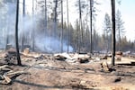
A photo posted by author Rick Steber on Monday, July 27, 2026, shows what remains of his cabin, which was destroyed. The cabin was near the head of McKay Valley, just north of Prineville.
Courtesy of Rick Steber
“I lost everything,” Steber said. “It was like a gut punch. Suddenly there was no air to breathe.”
Steber’s home was destroyed by the Green Mountain fire, which has since merged with other blazes in the Rowe Creek Fire Complex. It was burning 294,900 acres and was 33% contained as of Tuesday morning. The massive blaze is sweeping through one of Oregon’s most scenic high-desert areas, including the land around the Painted Hills.
Steber lived alone in the cabin. Two miles from the nearest neighbor, it was a quiet retreat where he spent many days writing books set in the West. The fire appears to have destroyed his research and much of his belongings, including a pickup truck and a treasured collection of folk music on cassette tapes.
“My brothers and sisters and my dad and I were the ones that built the cabin,” Steber said. “You don’t replace those memories. Since it’s happened, I wake up remembering little incidents, remembering things that were left behind that I’ll never see again.”

An undated provided photo of author Rick Steber. Steber’s cabin near the head of McKay Valley, just north of Prineville, was destroyed in a wildfire.
Courtesy of Rick Steber
Steber is running for Crook County commissioner. He won the May primary and is advancing to the November general election. He made a political point out of the fire’s severity, accusing Democratic leaders of mismanaging forests.
“We’ve allowed fuels to build up,” Steber said. “We’ve told local communities in Eastern Oregon, you need to become tourist destinations, a playground for the west side, and then we put everything on fire and destroy tourism. So what do we have? We don’t have a damn thing.”
About half of the land in Crook County is public and managed by the federal government. Some public parcels are under the jurisdiction of state agencies and Crook County.
For now, Steber is picking up the pieces of his life.
He’s staying in a tent beside his business near Prineville’s main street. Friends have offered him a place to stay, but he said: “I just kind of want to be by myself for a little while. I want to sort through all this.”
“I always tell people my motto is I’ll ride this horse until he dies, and then I’ll get off and start walking,” Steber said. “But I ain’t giving up.”
Update: 1 p.m. Tuesday, July 28
As fires spread throughout the state, Oregonians are finding ways to help those who are most impacted.
Take Karen McCarthy and Tari Donohue, who met up Tuesday at the Bi-Rite on the south end of Madras, near the Bench Fire.
The pair walked up and down the grocery store aisles, shopping for items like socks, underwear, drinks and snacks to donate to people who were evacuated from their homes on large swaths of the nearby Confederated Tribes of Warm Springs Reservation.
McCarthy, who owns the Madras Garden Depot, put a call out on Facebook on Monday to community members soliciting donations for people who are being evacuated from their homes.
“I really believe in a good community,” McCarthy said, “and I think that’s the only way – by helping each other.”
When they arrived at Bi-Mart, McCarthy and Donohue had about $400 in donations to shop with. But as McCarthy walked toward the front of the store, a friend stopped her and handed her another $50.
“Did you plan to run into us?” McCarthy asked. “Yeah,” the friend said.

Friends Tari Donohue, left, and Karen McCarthy load food, drinks, clothing and supplies for evacuees of the Bench Fire into McCarthy’s trunk in Madras, Ore., on July 28, 2026. They spent a total of $270.86 on supplies with money donated from community members.
Eli Imadali / OPB
Update: 12:30 p.m. Tuesday, July 28
The Bench Fire burning west of Madras in Central Oregon has reached more than 40,000 acres and was 0% contained as of Tuesday morning.
On the Warm Springs reservation, some residents have had to evacuate as the fire makes its way deeper into tribal land. Others are dealing with occasional power outages, boil water notices and other hardships.
“The fire is still expanding to the west,” Edward Henderson, the secretary treasurer/CEO for the Confederated Tribes of the Warm Springs, said on OPB’s Think Out Loud Tuesday. “Obviously we’re a timber-producing reservation. That’s a resource that, you know, if it was to be all burned up and gone, then that would take a real big dent out of the tribal government.”
Many residents are sheltering in place, Henderson said, while others are seeking refuge in a shelter in Warm Springs. The tribes have also issued precautionary notices for residents to conserve water and to boil their water before consuming it.
Henderson said the orders were issued after residents began running sprinklers and hoses as the fire approached population centers on the reservation.
“Prior to that we had all our tanks at 100%,” he said. “But people running sprinklers on hose out there really put a drain on it.”
Henderson said six homes have been lost in the fire.
Update: 12 p.m. Tuesday, July 28
Local authorities announced another round of downgraded evacuation notices for the Akawa Butte Fire burning in Deschutes and Jefferson counties.
The Deschutes County Sheriff’s Office made the announcement Tuesday as fire crews continued to make progress.
Several areas previously under Level 1 “Be Ready” evacuation notices have now returned to normal, and two other evacuation zones previously at Level 3 and Level 2 have also been downgraded, according to the sheriff’s office.
The Akawa Butte Fire is burning more than 27,000 acres as of Tuesday and is 6% contained.
Update: 11 a.m. Tuesday, July 28
Fire crews continue to make progress on the Hay Creek Fire Complex, a cluster of wildfires that have burned more than 173,000 acres in north central Oregon.
According to the Hay Creek incident management team, four of the five wildfires making up the complex were 100% contained as of Tuesday morning.
The remaining blaze, the Little Buck Fire near Shaniko in Wasco County, was 50% contained.
A community meeting is scheduled for 6:30 p.m. Wednesday, at the Veteran’s Memorial Hall in Condon, 128 S. Main St.
Update: 10:15 a.m. Tuesday, July 28
The Rowe Creek Fire Complex was burning across nearly 300,000 acres on Tuesday morning, making it the largest complex among dozens of wildfires burning across Oregon. The complex was listed at 33% contained.
According to the Rowe Creek incident management team, two smaller conflagrations — the Brewer and Green Mountain fires — have merged with the larger Crosswhite Fire. The crescent-shaped complex now covers western Wheeler County, northern Crook County, southeastern Jefferson County and southeastern Wasco County.
Fire officials expect cooler temperatures and reduced winds to allow the nearly 1,400 fire personnel working on the blaze to make progress Tuesday.
Residents in Antelope and Shaniko in Wasco County are under Level 3 “Go Now!” evacuation orders. There are resources in place for Wheeler and Wasco County residents to stay up to date on evacuations.
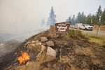
An undated provided photo shows fire damage. The Rowe Creek Fire Complex is burning across nearly 300,000 acres of Wheeler, Crook, Jefferson and Wasco Counties as of Tuesday, July 28.
courtesy of Rowe Creek Complex Public Information Officer Hannah Schwalbe
Update: 7 a.m. Tuesday, July 28
The Grasshopper Fire in Wasco County, just east of Mount Hood, reached 15,000 acres as of Tuesday morning, the Wasco County Sheriff’s Office said.
More than 2,000 people in the area were under Level 3 “Go Now!” evacuation orders, according to the State of Oregon Fires Dashboard. An evacuation shelter has been set up at Maupin High School.
The fire also closed some campgrounds and trails in Mt. Hood National Forest.
Update: 4 p.m. Monday, July 27
As of this afternoon, more than 6,200 people were under Level 3 “Go Now!” evacuations in Oregon. Another 26,000 were under lower levels of evacuation.
Some people have taken to social media to ask how they could help.
Multiple Portland-area businesses appear to be collecting donations for people who had to leave their homes in Warm Springs at a moment’s notice.
Financial gifts are the most effective way to help people during wildfires. People can donate funds to organizations like the American Red Cross, or find other trusted organizations currently involved in wildfire response by calling 211 or visiting 211info.org.
The Oregon Department of Emergency Management also has a list of trusted organizations that are accepting donations.
Meanwhile, more than 12,400 firefighters were working on wildfires in Oregon: digging containment lines, clearing brush and dropping water onto flames.
Rural, volunteer-run fire departments might be collecting items like bottled water. Generally, though, they have enough food and water.
“Firefighters are really well taken care of when they’re deployed out to these incidents,” said Kyle Williams, deputy director of fire operations at the Oregon Department of Forestry. “We get caterers out there. There’s showers in camp. You get a cool lunch.”
Williams suggested people donate to the Wildland Firefighter Foundation, which helps injured firefighters and the families of firefighters who have died.
People can also show their support through homemade signs thanking firefighters.
Update: 2:15 p.m. Monday, July 27
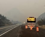
In this undated file photo, part of U.S. 26 is closed west of Prineville due to wildfires.
Courtesy of the Oregon Department of Transportation
The Oregon Department of Transportation is advising drivers to check road conditions before traveling in parts of Eastern or Central Oregon.
Wildfires burning near Interstate 84, between Baker City and Ontario, closed the freeway in the area. The road reopened Monday evening.
Transportation officials said parts of the freeway could open or close with little notice, as fire conditions are changing rapidly.
Wildfires have also closed parts of U.S. 20 and U.S. 26 east of the Cascades.
“Do not rely on GPS to find alternate routes,” an ODOT update said Monday afternoon. “Smaller highways cannot accommodate interstate traffic volumes and are easily congested or blocked.”
For 24/7 road conditions and traffic alerts in Oregon, visit tripcheck.com or call 5-1-1.
Update: 2 p.m. Monday, July 27
As of Monday, the Big Grass Fire, near Jordan Valley, also grew to nearly 200,000 acres, with only 5% containment, prompting Level 3 “Go Now!” evacuation orders for residents in the area.
Jordan Valley resident Tara Echave has been on the ground, watching it rapidly increase over the past three days and expressing heightened anxiety among community members.
“We cannot do it on our own. We need air support, and we need ground support from people who are skilled firefighters and have the right equipment,” she said.
Echave said the community has mobilized to provide food, drinks and supplies to firefighters and volunteers at the Mormon and Catholic churches, as well as at the Pleasant Valley School.
Monday morning, Owyhee County commissioners approved $30,000 in emergency funding. But each afternoon they are seeing winds pick up, and “wouldn’t take a whole lot for that fire to get going in the wrong direction.”
Echave said they are hoping for additional help from the state.
“It truly is a disaster for our community. We need help now, and we’re going to need it later too,” she said.
Update: 1:20 p.m. Monday, July 27
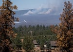
A firefighting aircraft flies over the southeast part of the Akawa Butte Fire, near a neighborhood on the northern outskirts of Sisters, Ore., on a windy afternoon on July 25, 2026.
Eli Imadali / OPB
The Deschutes County Sheriff’s Office reduced multiple evacuation levels Monday afternoon for several areas southeast of the Akawa Butte Fire.
Officials are reminding people in the area to drive carefully and to pay attention to roadblocks that might have moved. They are urging residents to take extra precautions when traveling as fire crews continue to extinguish hot spots near the fire lines.
The sheriff’s office is also warning residents that power may still be out in some areas. The Akawa Butte Fire is burning more than 27,000 acres in Deschutes and Jefferson counties and is 6% contained.
Update: 1 p.m. Monday, July 27
The Oregon Department of Environmental Quality issued an air quality advisory Monday due to the multiple wildfires burning in Southern, Central and Eastern Oregon.
The advisory is in effect for Baker, Crook, Gilliam, Grant, Harney, Jefferson, Malheur, Morrow, Umatilla, Union, Wallowa, Wasco and Wheeler counties until further notice.
Intermittent smoke and degraded air quality are possible in Deschutes, Eastern Douglas, Hood River, northern Jackson, northern Klamath, Lake and Sherman counties.
Smoke can irritate people’s eyes and lungs and worsen some medical conditions, and smoke levels can change quickly. People in the affected areas can check current conditions on the Oregon Smoke Information Blog and at the DEQ Air Quality Index,
Update: 12 p.m. Monday, July 27
Six homes and five agricultural buildings have burned in the Bench and Beachcomb fires in Warm Springs.
Those fires have merged and are now called the Bench Fire. It’s covering about 40,200 acres.
As of this morning, the out-of-control fire had “potential for extreme fire behavior” because of strong winds.
Nearly 400 people were under Level 3 “Go Now!” evacuation orders. Another 1,200 people were under lower evacuation levels.
Warm Springs resident Alysia Klick’ump told OPB that she and her husband tried to evacuate on Saturday, but couldn’t leave due to highway closures.
“We got packed up in camper to evacuate, and the highway closed on each end of our reservation,” Klick’ump said. “We couldn’t evacuate and were up until 1 or 2 a.m.”
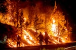
Firefighters burn off vegetation while trying to stop a wildfire called the Bench Fire from spreading in Warm Springs, Ore., on Saturday, July 25, 2026.
Noah Berger / AP
Chaotic weekend for wildfires
In Central Oregon, hundreds of people on the Confederated Tribes of the Warm Springs reservation have been under evacuation orders since late Saturday, due to the Bench and Beachcomb fires, which have since merged. That includes the entire Warm Springs Agency area, where most homes and businesses are located.
Related: Warm Springs reservation evacuates as Bench, Beachcomb fires merge
Road closures and confusion over maps complicated Saturday’s evacuation.
That night, evacuation maps weren’t available on WatchDuty, a widely used fire information app. And the highway connecting the reservation to Madras, the nearest city, closed intermittently. Evacuees shared videos on social media showing flames bordering the highway.
“The fire exhibited extreme behavior, including wind-driven runs and long-range spotting, creating three fronts that threatened the Warm Springs community,” fire officials said in an update Monday morning.
Other wildfires continue to threaten communities in Central and Eastern Oregon, including the Akawa Fire near Sisters and the Second Flat Fire near Burns and Hines.
Weather forecasters expect temperatures to remain high early in the week, potentially fueling fires.
Related: Homes lost, thousands under evacuation orders for Bench and Beachcomb fires
April Ehrlich, Amanda Linares, Jen Baires, Monica Carillo-Casas, Dirk VanderHart, Bryce Dole, Alejandro Figueroa and Kathryn Styer Martinez contributed to this report.