UPDATE (4:01 p.m. PT) — Multnomah County began approaching the threshold for a severe weather alert as of Monday afternoon, after largely avoiding a snowstorm Sunday night.
MORE: Portland, Willamette Valley Awake To Snow Tuesday
The National Weather Service is warning of potentially dangerous road conditions in time for rush hour Monday. That's as the county prepares to open severe weather shelters. The county says no one will be turned away.
Temperatures could reach as low as 28 degrees Monday night, creating the potential for black ice into the Tuesday morning commute. Lows Tuesday night could reach 25 degrees.
Freeze warnings have been issued throughout much the South Central Oregon Coast until 11 p.m. Monday evening. The NWS warns of sub-freezing temperatures that could kill crops and other sensitive vegetation.
Many school districts in the Portland metro area cancelled activities Monday evening.
Interstate 84 in eastern Oregon also saw an extended closure in the westbound lanes between Baker City and Pendleton on Monday following several vehicle crashes.
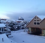
Snow is visible on Haystack Rock from Hemlock Street in Cannon Beach, Oregon, Monday, Feb. 4, 2019.
Courtesy of Juliet Hyams
On the coast, residents awoke Monday morning to a white blanket on streets and closed schools.
School districts in Astoria, Seaside, Warrenton, Hammond and Knappa closed Monday morning due to the snow. Farther along the coast, Tillamook County School district had a two-hour delay Monday.
"We’ve gotten reports of various snow amounts, most of the heaviest snow amounts have generally been above 1,000 feet or so," said Will Ahue, a meteorologist with the National Weather Service's Portland office. "But the coast has gotten some reports of about 1-2 inches, maybe some even spotty 3 inches."
Streets in Portland were clear Monday morning as temperatures for most of the region were too warm for the overnight rains to turn into snow. But the Multnomah County Sheriff’s Office says streets were slick in the higher elevations of the metro area, including Corbett in the Columbia River Gorge.
Most of the low elevation snow action during the early-morning hours was at the coast, where snow showers continued this morning. 1 to 2 inches has been reported on the coast from Lincoln City northward. Several inches has also fallen in the Coast Range. pic.twitter.com/CmisBu2mQM
— NWS Portland (@NWSPortland) February 4, 2019
The Statesman-Journal reports that temperatures in the mid-30s made for a snow-free but wet commute Monday morning for the mid-Willamette Valley. But as those temperatures drop throughout the day, the National Weather Service says areas around Salem above 500 feet could see snow accumulation.
In Lane County, winter weather caused several school districts to close or delay Monday, though the area was largely free of snow. The Register-Guard reports that the McKenzie-School District is closed due to a power outage.
Tuesday and Wednesday look dry, but Ahue said black ice could be of concern for the Tuesday morning commute.
"Temperatures are going to be below freezing tonight, so definitely with the residual moisture left from today's rain and snow, we definitely could see some icy spots on roads," he said.
Another system dropping out of the Gulf of Alaska in the latter half of the week could bring another chance of rain and valley snow.
"But there's still a lot of uncertainty with those systems," Ahue said.