Winter weather has arrived in Oregon, bringing heavy winds and rain to low-lying areas, snow to mountain passes and power outages across a swath of the northwestern quadrant of the state. And there could be more wet and cold to come in the days ahead.
About 30,000 Oregon homes and businesses lost electricity Saturday morning in a region that extends from the Willamette Valley up to Portland and west to the Oregon Coast, as winds buffeted the coast and snow blanketed mountains. By 4 p.m., about two thirds of those power failures had been addressed, but roughly 10,000 utility customers were still in the dark.
Related: Snowstorm won’t do much to lift Oregon out of drought, but it’s a start
Conditions began to improve in Portland and the Willamette Valley late Saturday morning, and high winds east of the Cascade Mountains died down by mid-afternoon, but cold, snow, and wind continued to affect across much of the rest of Oregon.
Along the north and central Oregon Coast, the National Weather service warned people that the surf zone is more dangerous than usual, especially at high tide, with a risk of sneaker waves that can knock people off their feet and pull them into frigid ocean waters. That threat could continue into Sunday morning. A beach hazards warning for the area will be in effect Saturday night through Monday afternoon. And along the south Oregon coast a high surf advisory is in place until 4 p.m. Monday.
Wet conditions contributed to a landslide that closed all lanes of U.S. Highway 101 north of Florence Saturday afternoon. State transportation officials said they expected crews to be clearing the 40 yards of debris until at least 7 p.m.
A winter storm warning was in effect for the Cascades until Sunday afternoon. The National Oceanic and Atmospheric Administration said the east slopes of the Cascades could see wind gusts as high as 45 miles per hour through Sunday afternoon, with as much as 20 inches of snow expected to fall at higher elevations.
NOAA is urging people to take precautions by securing outdoor objects that could blow away, and says to be careful in wooded areas, where tree limbs could fall on roads.

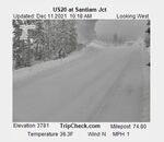
An Oregon Department of Transportation traffic camera showed snow on U.S. Highway 20 at Santiam Junction Saturday, Dec. 11, 2021.
Oregon Department of Transportation
Traffic cameras maintained by the Oregon Department of Transportation showed snow accumulation on all of the state’s major east-west Oregon mountain passes Saturday, including U.S. Highway 26 passing Mount Hood, U.S. 20 at Santiam Pass and Oregon 58 at the Willamette Pass.
ODOT was not reporting any unexpected major mountain road closures as of midday Saturday, but as snow continued to accumulate, the agency began to require vehicles to use traction tires or chains on some high elevation passes, including Santiam Pass, where 5 inches of fresh snow had fallen by 3:30 p.m., resulting in hazardous driving conditions.
With fewer people available to drive the state’s snowplows, as the East Oregonian reported, heavy snowfall could take longer to clear from major roadways than in the past.
Check Tripcheck.org for the latest traffic conditions on major roads and highways in the state.
The effects of the current weather front, which reached the Pacific Northwest by way of Alaska, are expected to subside by late Sunday or early Monday. But the National Weather Service forecasts more cold and wet days ahead.
Snow is unlikely to melt and could continue to accumulate at areas above 1,000 feet elevation through Tuesday, according to a National Weather Service forecast. The weather service expects chilly mornings with temperatures near freezing overnight in Northwest Oregon early next week, and very wet weather on Wednesday, before a shift to drier conditions at the end of next week.
