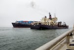
FILE - The US Army Corp of Engineers Dredge, Essayons, Oct. 4, 2023. The vessel helps maintain the navigation channel on the Columbia River Bar.
Kristian Foden-Vencil / OPB
The U.S. Army Corps of Engineers has dredged the lower Columbia River since the 1860s to create a deeper shipping channel between Portland and the Pacific Ocean.
The agency says the practice is necessary to support international commerce, but very few studies have been conducted on its ecological impact. Tribal leaders say dredging has contributed to the decline of lamprey, steelhead and other culturally significant species that rely on the Columbia estuary. Meanwhile, hydropower dams have caused a pileup of sediment in the mid-Columbia, slowing the river’s flow and raising water temperatures to dangerous levels.
Freelance journalist Josephine Woolington recently wrote about these issues for High Country News. She joins us with more details.
Note: The following transcript was transcribed digitally and validated for accuracy, readability and formatting by an OPB volunteer.
Dave Miller: From the Gert Boyle Studio at OPB, this is Think Out Loud. I’m Dave Miller. The U.S. Army Corps of Engineers has been dredging the lower Columbia River since the 1860s. It’s still doing so today. The boats may have gotten bigger, but the goal remains the same, to create a deeper shipping channel between Portland and the Pacific Ocean.
Of course, the river was used for trade long before white people arrived on the scene. The Columbia was a major trade route for Native peoples throughout the region. But as the freelance writer Josephine Woolington puts it, “while Chinookan peoples built boats to fit the river, the Corps built the river to fit boats.” Woolington explored how dredging the river has robbed it of nutrients and habitat in a new article in High Country News, and she joins us now. It’s great to have you back on the show.
Josephine Woolington: Thank you so much for having me.
Miller: A lot of your story focuses on dredging and commercial shipping, but you start out talking about canoes. Why?
Woolington: I wanted to place readers in a more historically accurate context. You say dredging has been happening for 160 years, since the 1860s, but canoes have been on the Columbia River for thousands of years. And I wanted to start with canoes because the Chinookan canoes that I was researching and that tribal people told me about are of varying shapes and styles, and those styles are based on the habitats within the river. And a lot of the habitats within the river are built from sediments. So there’s a small canoe known as a Wapato canoe that’s specifically designed for gathering the edible bulbs of wapato. That was a plant that used to grow abundantly in the Portland area. And then there were larger canoes for whale hunting and for clamming and fishing.
So, as you mentioned, the Chinookan approach was to build their boats to fit the river, not vice versa.
Miller: How did the sands that were brought down from a mighty river affect [or] create the ecosystems of the lower Columbia River pre-dredging?
Woolington: So the Columbia River’s estuary is huge. It’s from where present-day Bonneville Dam is to the mouth – about 145 miles. And the sediments that the river carries from upriver, a lot of the sand today is quartz sand, a geologist told me, from the Granite Mountains in British Columbia. And so that sand and all the sediments that the river gathers is exhaled into the estuary. And the water, how it once flowed without the levees, would be able to expand outward and create the foundations for marshes and deltas. The sediments also contain nutrients for plant growth. So the habitats are built and rely on those sediments, and that kind of flushing and building.
Miller: The undredged river, what kind of challenges did it present for industrial-scale shipping?
Woolington: When the United States expanded westward and began sending large ships upriver, the sand was a barrier. It snagged the large ships. Their drafts were too large, so they would be stuck, especially in the turbulent mouth of the Columbia. It’s famously known as the “Graveyard of the Pacific” because so much sand is moving. It’s interacting with the river’s current and the ocean’s current, but that was happening elsewhere in the river too – not as powerfully, of course, as it was at the mouth. But for example, around present day Kelly Point Park, just downriver from that spot, ships would frequently bottom out, the ships that were heading toward Portland.
And it’s because of the geology of the river at that point, the Tualatin Mountains, Portland’s West Hills, forces the Columbia to curve north. And when a river bends, it slows and sediments fall out. So that river bend built the habitats that we still see today, like Sauvie Island and the peninsula of Kelly Point Park, but that river bend, with so much sediment, prevented the ships from being able to reach Portland. So they would be stuck there and have to take their goods via some other way, like railroad.
Miller: How does dredging actually work?
Woolington: So I think of it as like digging the riverbed. I talk about Dredge Oregon, which is one of the dredging vessels used to dig the riverbed. How that particular vessel works is called a cutter suction dredge. It has a huge steel sphere that basically functions like an industrial egg beater. It churns the sediment of the riverbed, and as that sediment is churned up, a vacuum slurps it up. Dredge Oregon is the only dredge that can then spew the sand elsewhere.
Miller: Over the course of the last 160 years of history, where has that sand and gunk been put?
Woolington: Kind of all over the lower river. I mean, where we are right now is probably on dredge spoils, the entire city of Portland.
Miller: And we’re very close to the Willamette, in a flat part of the basin right here. So you’re saying that this would have been the site of dredge leavings?
Woolington: Yeah, maybe historian Carl Abbott would correct me [laughs]. It might have been garbage, dirt. They filled the city with a lot of things, but much of it was filled with dredge material from the Willamette, so the east side of Portland. Along the Columbia, present-day Portland International Airport is on dredge spoils, and all along the river, you can see piles of sand. The river islands that you see, there’s 15 that were created by the Army Corps to divert the river’s flow to help the shipping channel. Those islands are also dredge sand.
Miller: What dangers does dredging present for aquatic species?
Woolington: There’s a number of ways that dredging and the creation of the shipping channel has impacted aquatic species. I guess I’ll focus on the actual suctioning, the vacuuming. So you can imagine if you picked up a handful of dirt, all the critters that might be in there, and it’s similar with sand at the bottom of the river. It’s called Benthic communities, like crustaceans, sometimes lamprey, juvenile lamprey burrow in the river sediment. So when that sediment is sucked up and any fish that are nearby too can get vacuumed into the pipes and oftentimes killed. And then when the sediment is placed elsewhere, it can bury and suffocate any critters that were on the land when the pile came in.
Not many studies have been done on the impact of how many creatures are getting sucked up, especially on the lower Columbia there’s been no recent studies on that. So we really have no idea how many lamprey are getting sucked up, how many juvenile salmon. To give listeners a sense, in the ‘70s, there was a study on the Fraser River in British Columbia, and in one day, 26,000 juvenile salmon were inhaled into the dredge pipes.
Miller: What does the Army Corps of Engineers say about the ecological effects of their dredging?
Woolington: I think what they told me in written statements is that there have been studies, but those studies, like I mentioned, were from the ‘70s. Some were in Grays Harbor from the ‘80s. But they point to the ecological benefits. They say spewing the dredge elsewhere can rebuild habitat. But again, there’s not much evidence that their actions to do so have rebuilt habitat, especially for salmon.
Miller: We’ve been talking about efforts to remove sediment from the lower parts of the river, but what happens upriver behind dams?
Woolington: Upriver is kind of the opposite story. Historically, the Mid-Columbia River would have been fast, cold water moving down, carrying sediments that need to be deposited into the estuary. And what dams do is just sever that. The sediments have been building up behind the dams. I think if people have seen the photos from the Klamath Dam removal, there was a ton of sediment behind the dams, and that’s what it’s like behind Bonneville or The Dalles Dam.
One Yakama research scientist who I spoke with described the pool behind Bonneville Dam as being like a sandbox. What that does is it heats the river, especially near the tributary mouths like the Klickitat, or the Hood River, or the Deschutes. And you can actually see that the Hood River has a huge sandbar coming from it because those sediments are trapped and they have nowhere to go. About half of the sediment that should be delivered to the estuary to build habitat is stuck behind dams.
It also endangers tribal fishers. Some of the issues that the Corps has been working to relieve in the lower river so big boats can get up, that has been passed on to tribal fishers who might get stuck, their boats might be ensnared in the sand. And one Yakama research scientist who I referenced, he’s had fishermen friends pass away.
Miller: The Corps has proposed rebuilding wetlands using dredged sand. You were alluding to this earlier, but what exactly are they saying they want to do?
Woolington: That’s a good question. I don’t think it’s clear. One of the critiques of the proposal that the Corps has recently approved by the U.S. Fish and Wildlife Service is that the agency lacks a plan and a budget to do so. So I don’t know what that would look like. I think what they’ve told me, and they cite some projects elsewhere, but that they could use the sand to place in shallow water habitat, and that would be the start of wetlands so that plants would eventually grow on the sand.
But the sand that’s dredged from the bottom of the river largely lacks nutrients. How sediments naturally spill across the landscape is that the heavier sands would fall on top and then the finer materials that carry the nutrients, like nitrogen and phosphorus that would encourage plant growth, would then be layered on top. But when you just spew sediments from the bottom of the river, you don’t get that process. And of course, the Columbia River has a ton of invasive species, and there’s concern that if you build more potential land, that it will just be colonized by reed canary grass or purple loosestrife.
Miller: We started by talking about Indigenous history. I want to end by talking about Indigenous future. What have tribal officials said about this idea?
Woolington: I spoke with leaders from the Confederated Tribes of the Grand Ronde and the Chinook Indian Nation. And unfortunately, their voices haven’t been represented in conversations around this plan and around dredging over the decades. The chairwoman from Grand Ronde told me that the Army Corps has not consulted with the tribe, meaning, leaders from the Army Corps meet with tribal leaders, and the Army Corps does not consult with the Chinook Nation because they aren’t federally recognized, even though other federal agencies like the U.S. Fish and Wildlife do have relationships with the Chinook. And so they’ve largely been left out of these conversations.
Miller: Josephine, thanks very much.
Woolington: Thank you so much for having me.
Miller: Josephine Woolington is a freelance journalist and author based in Portland.
“Think Out Loud®” broadcasts live at noon every day and rebroadcasts at 8 p.m.
If you’d like to comment on any of the topics in this show or suggest a topic of your own, please get in touch with us on Facebook, send an email to thinkoutloud@opb.org, or you can leave a voicemail for us at 503-293-1983.