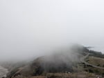
Fog wraps around a winding highway and coastal shoreline on Oregon's Yaquina Head in this provided photo from 2024. In a recent study, researchers used surfing webcams to better understand fog on the Oregon Coast.
Sonya Rauschenbach/UC Davis
Fog is a constant presence on the Oregon Coast, but it can be difficult to measure and track. In a recent study, researchers used webcams typically used to check surfing conditions to get a clearer picture of when and where fog forms and dissipates.
The team analyzed images from six cameras stretching from Cannon Beach to Yaquina Head and compared them with data from a visibility sensor at the Newport Municipal Airport that measures fog.
They found that while fog was often patchy and rapidly shifting between camera sites, the airport sensor still provided a reliable picture of average fog frequency along the coast.
Sonya Rauschenbach is a graduate student in atmospheric science at UC Davis and the lead author of the study. She joins us with more details.
Note: The following transcript was transcribed using AI and validated for accuracy, readability and formatting by an OPB volunteer.
Dave Miller: This is Think Out Loud on OPB. I’m Dave Miller. Fog is a constant presence on the Oregon coast, but it can be difficult to measure. In a recent study, researchers relied on webcams that are normally used to check surfing conditions to get a better picture of when and where fog forms and dissipates. The team analyzed images from six cameras stretching from Cannon Beach to Yaquina Head. Sonya Rauschenbach is a graduate student in atmospheric science at UC Davis and is the lead author of this new study. She joins us now. It’s great to have you on Think Out Loud.
Sonya Rauschenbach: Hi, it’s great to be here.
Miller: So let’s start with some basic definitions here. Is fog just a low cloud?
Rauschenbach: Yes, fog is a low cloud that touches the surface, and that can be the surface at higher elevation points on a mountain or right at sea level.
Miller: Oh, I’ve always thought if I’m climbing a mountain, and I’ve always thought I’m in the clouds now, but technically I’m in fog because the fog is at ground level and the ground is just higher.
Rauschenbach: Yes, exactly.
Miller: OK, what about mist? Is mist fog?
Rauschenbach: So, fog has, in the weather community, a very impact-based definition of a reduction in visibility of less than one kilometer, so a little over a mile. However, many times you might be walking along the coast and see kind of like a lighter fog or a puffy cloud, and so that probably doesn’t reduce visibility to that extent, and so you could call that mist.
Miller: OK, so sort of a difference of degree as opposed to…it’s still the same thing, it’s little bits of water droplets in the air?
Rauschenbach: Yes, yeah, exactly.
Miller: How does fog form? How do those droplets get there?
Rauschenbach: Fog forms through a variety of mechanisms, but on the Oregon coast, there are two main ways that fog forms. As you and the listeners know, the ocean is very cold along the Oregon coast. And because the ocean is so cold, when you get warm, moist air that moves over that very cold ocean, that air temperature will decrease and that relative humidity will increase to such an extent where droplets will begin to form. And then another way that fog forms is kind of through the day as the temperatures increase and decrease, like at nighttime when temperatures are coldest, again, when there is like a moisture source present, like from the ocean, you can get fog forming at the really cold hours of the night and early morning.
Miller: Because the water is evaporating?
Rauschenbach: Because the air temperature gets cold enough that the amount of water in the air, the relative humidity increases, and to the extent that droplets can begin to form.
Miller: Oh, as opposed to being in vapor form.
Rauschenbach: Yes, exactly, yeah, the droplets will be activated, that’s what we say.
Miller: What role can fog play in coastal ecosystems? I mean, near water ecosystems?
Rauschenbach: So really the reason the Oregon coast looks the way that it does is because there is this summertime fog, because there’s very little precipitation along the Oregon coast in summertime, fog is the direct input of moisture to like the Douglas Fir forests and like the more coastal prairie ecosystems. So we really wouldn’t have those if there wasn’t the presence of this summertime fog. So it’s a really important moisture source.
Miller: And those Doug Fir trees or lower shrubs, they have evolved in ways that can capture that fog as droplets?
Rauschenbach: Yes, so certain plants have evolved to be able to directly absorb water from fog on their leaves, but even plants that don’t have that adaptation like the Doug Fir trees, they can capture fog in their leaves and branches and the fog water will then drip down into the soil and become a source of moisture, both for the trees and then also for the plants on the ground as well.
Miller: So what was the gap in information about fog trends that you wanted to try to fill in with this study?
Rauschenbach: Yeah, so as you may have noticed driving Highway 101, you can kind of get to a point where you’ll see fog, and then there’s another point and it will be clearer, and then another part, and it’s foggy again. So fog is really patchy and variable along the coast, and that can make it difficult to understand how fog has changed in the past and might change in the future. And so we wanted to try to quantify that variability and understand if sites that were closer together had more or less related fog patterns.
Miller: Why is it important to track this information? I mean, who might actually use it?
Rauschenbach: Researchers who are interested in understanding how important fog is for the ecosystems and kind of like what threshold of fog is necessary for ecosystem health, and then also to kind of understand the future fog trends because ecosystems could be at risk depending on if there’s like less fog expected in the future.
Miller: What have researchers in the past relied on to try to answer these questions?
Rauschenbach: A key source of long-term fog trends come from airports. Fog is measured on the ground with a very expensive instrumentation that measures the visibility levels. And so every airport will have a visibility sensor because of how important it is for air travel safety to understand fog. However, at like a forest ecosystem or just along the coast, visibility sensors aren’t kind of readily set up. And so researchers rely on the airport fog data to look at the past, and predict the future of fog. However, airports have a different surface structure, and fog is really sensitive to how hot the surface is. If the surface gets hot, then the fog will dissipate or lift and become a low cloud. And so because airports have a different surface structure with the tarmac than an ecosystem, one motivation for the study was to understand how well those airport fog trends relate to fog along the coast.
Miller: Where did your team get the idea to use surfing webcams to track this?
Rauschenbach: Yeah, so one of my co-authors, John Kim at the Forest Service, he is a surfer, and was kind of aware of these cameras, and he just wondered, is this a data source that has been untapped and can be used to identify fog?
Miller: So what did you find?
Rauschenbach: So we found, importantly, that if you look at the kind of monthly average fog trends at all five sites that you mentioned along the coast, that the airport correlates pretty well to those monthly averages. However, when you get to shorter time scales, like the daily time scale, fog is highly variable and actually most likely to show up, like over half of the times when fog shows up, it’s only at one or two sites. And I was actually speaking to a woman along the Oregon Coast about this. And she said, “So does that mean that if I’m at Lincoln City, and I drive down to another beach site, that it won’t be foggy there?” And I was like, “Yes.”
However, we also found that it’s very likely on the same day that fog will show up at other locations. So it’s really moving around the coast. And we also found that at the daily time scale, sites that are closer together, their fog trends were more strongly related. However, when you look at kind of the seasonal cycle and the hourly cycle of fog, sites which are closer together were not more related, which suggests that there’s other drivers of variability in fog, for example, possibly topography or near shore ocean temperatures, that are driving fog variability.
Miller: So what do you see as the main takeaways for people who might rely on information about fog conditions. What can they take from this study?
Rauschenbach: I think the main takeaway is that we can rely on the airport fog data, even if there’s less fog at the airport, it still correlates pretty well to fog along the coast. If you’re really looking for larger, like a climatological analysis.
Miller: Meaning like a longer term analysis, if not like it’s foggy at the airport, therefore it’s foggy 20 miles towards the coast, that part may not be true.
Rauschenbach: Yes, that part is likely not true. However, I think another thing that our study showed is just how much there is to still understand what drives the variability in fog occurrence in the short term, to better predict fog, like whether or not there will be fog at a certain location. And using just the airport weather data, if you want to predict fog at any of the sites along the coast, there’s not enough information there, which kind of points to how cameras could be used to detect fog in real time.
Miller: So what about the longer term? Do you as researchers, do you have a sense for how fog patterns could change because of climate change?
Rauschenbach: It’s an active area of research, and it’s actually tricky to predict, like the short answer is that we don’t know. And that is because fog formation depends on the temperature difference between the ocean and the air. So even if we would expect the ocean temperature and the air temperature, on average, to both increase, it’s really the relative rate of increase that will be impactful for fog. So there is a future where there could be more fog if the air temperature warms faster than the ocean temperature, and similarly, a future where there could be less fog or no change.
And also the kind of wind patterns along the coast impact the upwelling, which brings, like, that cold water along the Oregon coast. And so if there’s any change in the summertime wind patterns from climate change, it’s difficult to predict, that would also impact fog formation.
Miller: Just briefly, I understand that the next kind of fog that you’re studying now is Arctic fog. What should everybody know about this thing that many of us may never encounter?
Rauschenbach: I think the coolest thing about Arctic fog is that it’s not just liquid, you also get ice fog, and you get liquid and ice kind of existing at the same time, which can really wreak havoc on infrastructure, because it will just ice up kind of all the infrastructure there. And I think that that is, it’s some fascinating physics happening there.
Miller: Sonya Rauschenbach is a graduate student in atmospheric sciences at UC Davis.
“Think Out Loud®” broadcasts live at noon every day and rebroadcasts at 8 p.m.
If you’d like to comment on any of the topics in this show or suggest a topic of your own, please get in touch with us on Facebook, send an email to thinkoutloud@opb.org, or you can leave a voicemail for us at 503-293-1983.