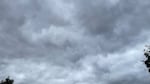
A cloudy sky paves the way for rain and a steep drop in temperatures throughout Oregon during the first week of September 2026.
Jeff Thompson / OPB
After a warm start to the week, residents across the Portland metro area experienced a sudden drop in temperatures on Tuesday. In some places, high temperatures dropped from the 80s to the 60s.
A cold front moving in from Alaska is affecting all of Oregon and Southwest Washington. Rainfall will bring relief to fire-ravaged areas, while the National Weather Service has issued a frost advisory for parts of Southern Oregon.
Brian Nieuwenhuis, a senior meteorologist with the National Weather Service based in Medford, said these cold temps and widespread showers don’t usually arrive until October.
“It looks like we’re transitioning a little sooner than normal in the fall,” Nieuwenhuis said. But he said the weather could easily shift back. “It could very easily be that in two weeks we’re back into the heat again.”
Improved air quality throughout the Willamette Valley
Westerly winds from the Pacific Ocean are cooling down the Willamette Valley and pushing back the smoke from Oregon wildfires. Shifting winds, aided by the rain, will improve the air quality in the region, according to the National Weather Service.
A marine layer from the ocean has also settled in, providing a cloudy cover over the Portland metro area. From Tuesday night through Thursday, people will see about 0.5 to 0.75 inches of rain showering the region.
We're starting off Meteorological Fall with a bang - it's time to get out those rain jackets and/or umbrellas! ☔️🌧️ Tomorrow (Wednesday) a frontal system is slated to bring a mix of widespread rain and locally breezy winds followed by showers/T-storms on Thursday. #wawx #orwx pic.twitter.com/zup7fC6Rlk
— NWS Portland (@NWSPortland) September 1, 2026
While the National Weather Service expects gloomy conditions might linger, precipitation is likely to halt by the weekend.
Freezing risk and potential thunderstorms
As the cold front clashes with hot air on land, the sudden disturbance could lead to stormy weather. The Cascades and Wallowa Mountains might see isolated thunderstorms, according to the National Weather Service.
The agency also issued a frost advisory for Lake and Klamath counties in Southern Oregon, and Modoc County in California. They could see borderline frosty temperatures in the low to mid-30s Wednesday, between 4 a.m. and 8 a.m. Residents should be mindful of pets and plants outside that are not acclimated to cold weather.
Early morning lows on Wednesday may reach between 33 and 38 degrees in some low-lying areas east of the Cascades. Please be aware of local conditions and take steps to protect sensitive pets, livestock, and agriculture from possible frost-building conditions. #ORwx #CAwx pic.twitter.com/2knczD0hnJ
— NWS Medford (@NWSMedford) August 31, 2026
The Brookings area could see heavier rains, of about 2-3 inches, over the next several days. Other cities in southeastern Oregon will feel gusts up to 20 miles per hour. A wind advisory is in effect for northeast California, and officials are warning drivers in tall and wide vehicles that high winds could make it difficult to navigate their commutes.
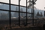
FILE - A burned structure near the unincorporated community of Friend, Ore. on Aug 14, 2026. The Grasshopper Fire destroyed at least 20 structures and six homes as of Thursday, Aug. 13.
Saskia Hatvany / OPB
Rainfall provides relief to wildfires in Oregon
Most of the state will receive rain, from Central Oregon to the Columbia Basin, helping to dampen the state’s largest blazes, like the Grasshopper Fire and Austin Fire.
This summer, low humidities and extreme heat have been a deadly combo fueling the conflagrations east of the Cascades. The Northwest Coordination Center in Portland, which coordinates state and federal agencies battling wildfires in Oregon and Washington, was so busy that Montana-based meteorologist Bob Nester came out of retirement to help with briefings.
Nester said the rain won’t completely extinguish the fires, but it will make a significant impact mitigating risk.
“When you have rain in your area, your relative humidity skyrockets pretty high,” he said. He said he has seen forecasts for the coming days that predict humidity levels of about 40 to 50% east of the Cascades — up from the single-digit percentages he saw this summer. “That limits any kind of growth and ignition potential for fires.”
Nieuwenhuis said this wetting rain also soaks through the forest canopy into the vegetation that kindles wildfires, tamping down on the spread of a blaze.
“Fire likes to spread along the ground. Once you wet that down, it’s very hard for that fire to spread,” he said.
The downpour could put a hold on fire season, but Nieuwenhuis said it’s still too early to predict whether it will come to a complete stop. “We can get pretty dry in September and October, so I don’t want to say it’s going to end the season.”
Even with rain in the forecast, it is still best to cover your pile and wait to burn. Fuels across the state remain extremely dry and we're going to need more consistent wetting rains before it's safe to debris burn.
— Oregon Forestry (@ORDeptForestry) September 1, 2026
Check local fire restrictions at https://t.co/ubaQlhebmf pic.twitter.com/IXskUtScWl
Resources: Stay safe and informed during wildfire season with OPB’s wildfire guide at opb.org/wildfires. This resource offers essential safety tips and preparedness guidance to help you navigate fire and smoke events. This resource was created as part of our commitment to serving the public as wildfire seasons become longer and more dangerous.
Correction: An earlier version of this county misstated the location of Modoc County. OPB regrets the error.