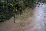
Waters rise in Johnson Creek in Portland, Ore., on March 12, 2026. El Niño is expected to bring a warmer, wetter winter to Oregon, increasing the risk of floods and landslides.
Eli Imadali / OPB
The weather pattern known as El Niño is still gathering strength, and climatologists say it could be one of the strongest on record.
The phenomenon is caused by rising surface temperatures in the central and eastern tropical Pacific Ocean. The weather pattern is expected to bring big impacts to Oregon come winter. State Climatologist Larry O’Neill says that’s likely to mean warmer and wetter weather. He joins us to tell us more.
Note: The following transcript was transcribed using AI and validated for accuracy, readability and formatting by an OPB volunteer.
Dave Miller: This is Think Out Loud on OPB. I’m Dave Miller. Happy “the rain is back” week to all who celebrate. What a welcome sight for a parched state. But what can we expect for the fall and the winter? What is the so-called super El Niño likely to bring? Larry O’Neill joins us to talk about this. He is a professor in the College of Earth, Ocean and Atmospheric Sciences at Oregon State University, and he is Oregon’s state climatologist. Larry, welcome back.
Larry O’Neill: Great. Thank you for having me.
Miller: Before we get to a super El Niño, let’s start more with the basics. Can you remind us what an El Niño is?
O’Neill: Yeah, an El Niño is just a warming of the ocean along the equator in the Pacific, and it’s basically an anomalous warming, and there’s a counterpart to El Niño which is a La Niña, and that’s a cooling of the ocean. And the main reasons we care about that is because when you perturb the temperature along the equator like that, it basically disturbs the weather patterns all around the globe and especially into the Pacific Northwest.
Miller: What makes climate model people say that this is going to be an especially strong El Niño, a super El Niño?
O’Neill: Right now we’re actually, just with our observations from satellites and from buoys and ships and other things, right now the equator along the Pacific Ocean is now much warmer than it’s been at this time of year, so we’re setting records here. And so the El Niño has developed and right now over the next couple of months it’ll keep strengthening and it usually strengthens by, or reaches its peak intensity sometime in the winter, so I think sometime between December and February. And that’s usually when we see the biggest impacts. And so right now, a lot of our models are suggesting that this could be or this very likely will be the strongest, the warmest that we’ve ever seen the ocean there.
Miller: I’ve heard you say that, and we’re not just talking about the surface of the ocean in the Pacific, which is unprecedentedly warm, but it’s even the seawater well below the surface. What does that mean?
O’Neill: That’s right. So basically during an El Niño, there’s a reduction in the upwelling of water near the equator and so that warms the whole water column. And during an El Niño, actually the ocean basically gives up a lot of that heat to the atmosphere all at once. So all that subsurface heat that we see, a lot of that can go up into the atmosphere. And so that really also warms basically the whole planet at once.
So we can actually expect quite a bit warmer weather as we go forward. Right now we have buoys and things that measure the subsurface in the ocean, so think hundreds of thousands of feet deep, and we’re seeing right now temperatures we’ve never seen at depth below the ocean right now. So we know that this El Niño will continue strengthening as we go forward.
Miller: We are talking about cyclical patterns here: La Niñas, El Niños, cycling back and forth with some regularity, but is it fair to say that the extreme nature of what’s brewing now is a direct result of climate change?
O’Neill: Yeah, so El Niños and La Niños are natural. It’s a natural phenomenon, so it’s been going on for a long time. What makes this so special is that it’s much warmer than we’ve seen before and it’s occurring in the background in which both the oceans and atmospheres are warming steadily because of climate change. And so the fact that this one is the strongest, maybe the strongest we’ve ever seen, it’s probably not exactly due to climate change, some of it is, but the impacts that we get, climate change will change some of the impacts that we see from the El Niño.
Miller: So I want to turn to those impacts now and specifically what it could mean for Oregon, because here’s where I’ve found it to be a little bit confusing because there seems to be, as you’re saying, a very high certainty that it’s going to be a historically powerful El Niño. But there seems to be less certainty about the effects. What normally happens in Oregon during an average strength El Niño?
O’Neill: Yeah, so the rule of thumb for El Niños is basically warm and dry for the Pacific Northwest and especially for Oregon, and that occurs for kind of more, like you said, the average El Niño, so one that’s kind of a lesser strength than this one will be. What we see right now is when we’ve had the strongest El Niños, basically the ones that have the warmest water along the Pacific, there have been three of these such events since the early 80s, so that would be 1982-83, 97-98, and 2015 and 2016.
During all three of those events, we saw actually Oregon was a bit wetter than normal, and we actually had average to above average snowpack. And during those events, it was also very warm in Oregon, and the last event was in 2015, 2016. That was Oregon’s warmest year on record. And right now, so far this year, Oregon as a state is tied for its third warmest start to a calendar year. So we are expecting that this warmth to increase and continue all through the winter and into next spring.
Miller: How do you explain the fact that, looking at that, 2015 to 2016, that both one of the warmest years on record also led to above average snowpack. I ask this because, I mean, my general understanding of winters here are when there’s precipitation and it’s warm, it’s rain in the mountains, depending, I mean, unless you get really high up. And if it’s cold and wet, that’s when you get the snow. So how can an above average warm year lead to more snowpack?
O’Neill: Yeah, so actually in 2015, 2016, we actually had a relatively poor snowpack. That was actually one of our worst snow years on record. And during that time, because it was so warm, a lot of the precipitation that we got just fell as rain rather than snow at higher elevations. And so that’s kind of what happens. During these really strong events that we expect, is that basically the snow line goes far, it’s far higher in the mountains than it usually is.
Miller: OK, maybe I misheard you then. So then the point is that in an average El Niño year, it’s warm and dry; in a really strong El Niño year, still warm, but wetter, meaning rain?
O’Neill: Yes, and that’s kind of unique to Oregon, Western Oregon, and especially towards Southern Oregon. And during these very strong El Niño events, actually California tends to be much wetter than normal, and so a lot of the storms that we would get further north, they actually go further south. Those storms tend to have an origin. They take in more tropical moisture, a lot more tropical moisture, and so that storm track will bring all that moisture into like California and then into Southern and Central Oregon as well.
Miller: But if we’re looking at an El Niño of unprecedented strength, how much can we trust the old models?
O’Neill: Yeah, that’s a great question, and we’re about to find out. So right now, not only because of how strong this El Niño is, but also because of climate change, some of these rules of thumb aren’t necessarily operating as they have in the past. And I’ll give one example, last winter was actually a weak La Niña. During a weak La Niña in Oregon, we actually experienced about average to above average snowpack and precipitation. And we got the worst snowpack in our state’s recorded history, as it turns out, and it was also dry throughout much of the state. So Oregon experienced its 16th driest winter, and that’s why right now we are in such a deep drought right now. And so, yeah, so some of these outcomes that we expected historically aren’t necessarily coming out as we usually have seen them.
Miller: When you say wetter than average in some of the historically strong El Niños in the past, do you mean periods of very heavy rain or more like a lot of drizzle?
O’Neill: Yeah, that’s a good question. We actually get more atmospheric rivers and so atmospheric rivers are the juiciest of like the cold fronts that we get.
Miller: That’s a polite way to put it.
O’Neill: Yes. And so we just get kind of more of those. So yeah, more heavier rain events. One thing about climate change is that we’re seeing, all across the globe, but especially in parts of United States and in the Pacific Northwest, is that some of the heaviest rain events are actually a little bit heavier than they used to be and that’s because the atmosphere is warmer and it holds more moisture. So it’ll be interesting to see what happens this winter when it’s so much warmer and we have more subtropical moisture or we expect more subtropical moisture than we usually get.
Miller: Is it possible then that we could be looking at flooding?
O’Neill: I’m not predicting that, but I think we should be prepared for a wide range of circumstances. And so just thinking about the old rule of thumb that El Niños are dry, if you were to prepare for a dry outcome, then maybe you wouldn’t be prepared in case we got a lot of heavy precipitation and flooding and things like that. And so some of our worst floods have occurred during, well, in a wide variety of things, but during very strong El Niño events we’ve had in the past, we have had some flooding within Oregon, due to the heavy precipitation, but also to the fact that oftentimes we’ll get some snow in the mountains and then we’ll get a warm rain system and so it’s what we call a rain on snow event, and those can bring some of our most consequential floods downstream in river valleys that drain off the Cascades.
Miller: So as you mentioned, we’re coming off of the worst snowpack year in Oregon’s history, and this year, to the best of the model’s ability, and given Oregon’s history with extreme El Niños, we’re looking at warm and wet, but not snowy. What could that mean overall for drought and aquifers and the water year to come?
O’Neill: Yeah, so, just to set the stage for it is that we’ve, right now because of really poor snowpack and the poor precipitation last winter, the state is in a very severe drought right now. A lot of our reservoirs are projected to be empty or nearly empty going into fall. And a lot of our stream flows and rivers are at some of their lowest levels that we’ve ever recorded across the state and obviously we’ve also had a very bad wildfire season that was driven in part by the drought conditions on the landscape.
And so we really need a wet outcome to start to recover from the drought and to kind of build back up our water supplies in the reservoirs and also the groundwater, as you mentioned, aquifers, things like that. So there’s a lot riding on on this winter and how wet it is. If we end up with a really dry El Niño, then the drought conditions will be even worse and the impacts from the drought next spring and summer will be much worse than they were this year. On the flip side, if we get a wetter than normal winter, we can begin to fill the reservoirs and recover our groundwater.
The real wild card here is what happens with the snowpack, because the snowpack determines about 40 or 50% of our state’s water supply, and if we have another year of bad snowpack, then that will really strain our water supply and really accentuate those adverse impacts on both agriculture, hydropower generation, our ecology, our fisheries, and also for wildfire risk going into next year.
Miller: All of those are more important than the question I’m going to ask you. But for people who like to play in the snow, is there any place in the West that you think is likely to have better snow than other places in an extreme El Niño year?
O’Neill: Yeah, California and going into kind of the Southwest U.S. a bit. I think towards Utah, there’s a little bit of a wild card how good the snowpack will be, but California seems to be more likely to have better snow, better rain, and things than we could possibly get.
Miller: Although that doesn’t help you if you’re an operator on Mount Hood or Willamette Pass or Bachelor or anywhere else in Oregon.
O’Neill: Yeah, so I think there’s still, and I keep getting asked this question a lot, is whether you should get a lift ticket this year, a season pass. And I think we’re still a little bit in wait and see mode, but I think we can’t do much worse than we did last year. And so there is all these potential outcomes that we’ve been talking about, they’re not set in stone and there’s a lot of variations between individual El Niño events, so it could end up being, there is a possibility that we could have a really good snowpack. But if we want to just kind of go by historical characterizations, what we can think about historically, I think the odds are tilted that, because it’s so warm, we might not get quite as good snowpack, but even like an 80% of average snowpack would be much better than what we had last year.
Miller: Just briefly, I’m going to turn from more future oriented or six-month time window questions to the next week or so. What is this current rain, not just in the west side, but on the east side and Southern Oregon as well, what does it mean for the current fire season?
O’Neill: Yeah, that’s a great question. So it definitely helps reduce the wildfire risk and it definitely helps reduce the wildfire activity. So it’s not necessarily going to put out the fires, but it will slow them down, not only the precipitation itself, but the cooler temperatures and the moister air. So we’re getting a lot better of what we call humidity recoveries at night, and essentially when the relative humidity gets much higher during the night, that slows down fire activity and it allows the fire personnel to get to contain the fires faster. And so what this system does right now is it really is the shot in the arm that we needed to really get this fire season under control.
With that said, it’s still really dry on the east side, historically dry, and this rain isn’t gonna completely reduce the wildfire or eliminate the wildfire risk, but it will reduce it. Fire season will continue probably until the end of September or into October in those places, so there’s still a risk that we could get another, more ignitions and more fires, but we don’t expect like what we got in mid-to-late July where we had the large lightning outbreak and all those wildfires start.
Miller: And just on a personal note, I’m curious what it’s been like for you, what it’s like for you now to do this work as climate change gets worse.
O’Neill: It is, as a climatologist, it could be really challenging because for years we’ve been studying the climate and we can see the temperatures increasing, we can see some of these indicators change and then we have these models that suggest that these indicators are going to change a certain way and right now we’re actually experiencing the impacts that we’ve theorized were going to happen. So wildfire risk, increased drought, water supply stress, and a lot of these things. And so it is really challenging to kind of keep on top of that and then to also just get the word out to people about what climate change means to them.
It’s no longer an abstract notion. We’re actually experiencing that right now. And another thing that’s really challenging with that too is that a lot of people live here, we’ve only lived here maybe 10, 20 years or so, and so you could kind of see how things, the weather and the climate have changed a little bit during that window. But, as a climatologist, we’re kind of like the historians of the weather and climate and so really what we want to communicate is how things were actually 30 or 40 years ago or 50 years ago when hardly anyone can remember what it was and we try to use the data to do that and we try to get the point across about how things have changed. What and how that impacts us.
Miller: It’s fascinating because I don’t know, maybe this is just my limited empathetic imagination or experience of the world, but I feel like what you’re asking people seems very hard for the average human. We’re so used to comparing what we’re experiencing to our own experience that I think it’s hard to truly feel like this is different from what was something that I did not experience 50 years ago. I think that’s just a hard thing for humans to do.
O’Neill: It is, yeah, and that really gets to the challenge of doing this because it’s not just analyzing the data that really matters here. It’s actually bringing that synthesis to people with what they’ve experienced in the past and what we’ve experienced. And one of the reasons it is so important is because our society has been built on, with this past climate that no longer exists and so now things have to change, things like our water supply, how we generate electricity, our ecosystems, our fisheries, our agriculture, where we get our food, our recreation capabilities, where we can build, all those things are changing now or need to change because we no longer live in the climate in which all that stuff was built. Yeah, so it’s a challenge for that.
Miller: Larry, we’ll talk again. Thanks very much.
O’Neill: You’re welcome. Thank you.
Miller: Larry O’Neill is a state climatologist of Oregon. He is a professor in the College of Earth, Ocean and Atmospheric Sciences at Oregon State University.
“Think Out Loud®” broadcasts live at noon every day and rebroadcasts at 8 p.m.
If you’d like to comment on any of the topics in this show or suggest a topic of your own, please get in touch with us on Facebook, send an email to thinkoutloud@opb.org, or you can leave a voicemail for us at 503-293-1983.