
A much-anticipated “super” El Niño weather pattern is shaping up to be one of the strongest on record, but the jury’s still out on whether it’ll bring significantly more rain to Oregon as the state reels from low snowpack, drought and wildfires.
An increase in the water supply could be a boon for the state’s struggling reservoirs. But it may put more pressure on the state and local communities to mitigate flood and landslide risks.

FILE - A landslide from the previous night is coned off on Southeast Gordon Creek Road, between Southeast Rickert Road and Southeast Trout Creek Road, sliding toward the Sandy River in Corbett, Ore., on March 13, 2026.
Eli Imadali / OPB
Whereas weak El Niños are typically drier, “We end up with more potential flood events during the very strong El Niños,” Larry O’Neill, Oregon’s state climatologist, said.
Some of the most severe flooding could hit low-lying areas along the Oregon Coast as increased rainfall combines with annual king tides, the highest tides of the year. The first week of king tides begins Nov. 23.
Rhiannon Bezore with the Oregon Coastal Management Program said flooding has already occurred along the coast, and she expects more to come, especially during storms.
“Sometimes, when all of these things happen at the same time, you could just have these massive impacts on our coast,” Bezore said.
The combination of warm temperatures and increased rain during a strong El Niño could also melt existing snowpack, leading to downstream flooding.
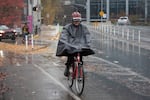
A biker rides in the rain on Nov. 10, 2026, in Portland, Ore.
Jenny Kane / OPB
“Some of Oregon’s most severe flood events, especially in the Willamette Valley, have been associated with rain on snow events,” O’Neill said.
Patence Winningham, deputy director of the Oregon Department of Emergency Management, said heavy rains could still more heavily impact areas east of the Cascades, where there’s less vegetation to absorb excess water. She pointed to severe flooding in Harney County in 2025, where heavy rain and rapid snowmelt inundated roads and damaged homes.
Winningham also said drought-stricken and burn-scarred lands will have a harder time absorbing water, making land and mudslides more likely in those areas.
“We’ve burnt so much land in Oregon, the runoff could be significant,” she said.
While Oregon experienced fewer wildfires in 2026 than usual, the blazes burned a record-breaking 2.1 million acres.
Scientists say it’s still unclear whether ultra-wet conditions will come to Oregon — or whether this El Niño will buck past trends.
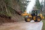
FILE - A Multnomah County Transportation Division crew works to clear mud and downed trees from Southeast Hurlburt Road, just east of its intersection with Southeast Evans Road, after a landslide in Corbett, Ore., on March 13, 2026.
Eli Imadali / OPB
According to O’Neill, the last three very strong El Niños in Oregon — in 1982, 1997 and 2015 — were wetter than normal.
“There’s actually quite a wide range of outcomes here that we could expect,” he said.
Adam Batz, a meteorologist with the National Weather Service in Portland, said precipitation levels this winter could still fall flat against the hype.

A car drives in the rain on Nov. 10, 2026, in Portland, Ore.
Jenny Kane / OPB
“It’s one of those things where we can’t really say, ‘Oh, it’s gonna be a really bad flood season, or ‘It’s gonna be well above average,’” Batz said.
Authorities with OEM and the U.S. Army Corps of Engineers are preparing for both scenarios.
“On the western side of the Cascades, we’ve got several flood control dams that can help us hold back water,” Winningham said.
Winningham said OEM has a watch desk that monitors data, including stream flows and forecasts, so the agency can predict landslide risk and debris flows before they happen.
But Winningham added that some areas of the state are less prepared for flooding due to lack of infrastructure funding for things like levees.

FILE - High water levels have increased the flow at Buck Creek in Corbett, Ore., March 13, 2026.
Eli Imadali / OPB
She encourages residents, especially in more at-risk areas, to check if their home or renter’s insurance policies cover flood damage.
“Most homeowner’s and renter’s insurance policies do not cover flood damages,” she said. “That’s something we saw in Harney County [in 2025]. Many of them were trailers.
“It goes back to our own individual preparedness on how we can care for ourselves and our families and our neighbors, and knowing what your hazards or risks are around your home.”
