
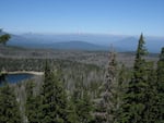
Damage from mountain pine beetles on lodgepole and whitebark pine trees in Deschutes National Forest.
Courtesy of Oregon State University
You might call it the forester's version of Google Earth: new satellite mapping that's giving scientists a clearer view of insect outbreaks in Northwest forests.
A study published this week describes how scientists with Oregon State University have combined new satellite imagery with older data from airplane and ground surveys to show in unprecedented detail where insects are damaging trees in the region.
Study co-author Garrett Meigs said these new maps create an atlas of insect-caused tree mortality that allows scientists to identify hotspots and zero in on possible causes.
"With this new technique, we can now see actual vegetation change from insects," he said. "We can identify both the hotspots as well as the actual amount of change that's occurred there."
Eventually, the new data could help scientists predict future outbreaks, which could help land managers improve forest health.
"One of the key next steps is to really see what contributed to specific outbreaks," Meigs said. "One of the implications we see is that we could anticipate where future outbreaks might be most likely to occur."
In the study, scientists compared the impacts of two native forest insects: the mountain pine beetle and the Western spruce budworm. Outbreaks of both insects can affect millions of acres of forest lands annually.
The mountain pine beetle has killed lodgepole pine trees across much of western Canada and the United States. Western spruce budworm defoliates Douglas fir, spruce and true firs and can make the trees more vulnerable to other stresses that may eventually kill them.
The study found the budworm has affected a greater area and caused more total tree mortality than the mountain pine beetle. It identified hotspots east of the Cascades in Washington and in Central Oregon where both insects have had impacts on the same forests.
Helen Maffei, a U.S. Forest Service scientist in Bend, Oregon, said satellite mapping could help scientists learn more about how forests recover from insect outbreaks.
"Mortality from bark beetles is only the beginning of long-term change," she said. "Dead trees fall and decay, and forest regrowth begins and continues over many decades. This new technique can help us understand not only how insect outbreaks are initiated and spread but also address the question, 'What comes next'? It can help us better understand the process of recovery."
A partnership between OSU and Google could eventually make satellite mapping of insect outbreaks available to all forest managers.