Portland’s National Weather Service office is considering emergency text alerts to notify emergency managers and government leaders when weather changes occur more quickly than anticipated, a potentially necessary move after February’s crippling snowstorm.
The National Oceanic and Atmospheric Administration’s Portland National Weather Service met in a closed-door meeting Wednesday with more than two dozen emergency managers, public works and transportation officials from Multnomah, Clackamas, Washington, Columbia counties in Oregon and Clark County in Washington. They discussed how to streamline communication and avoid mishaps in future extreme weather events.

A driver gets a push after being stuck in the snow, in southwest Portland, Feb. 23, 2023. Heavy snowfall began on Wednesday afternoon, making it the second-snowiest day ever recorded in the city.
Kristyna Wentz-Graff / OPB
Ahead of the February storm, the agency forecasted there was a 10% chance the Portland metro region would get 3 inches of snow and a 1% chance of 8 inches. But the storm dumped a near record 11 inches that caused transportation chaos on highways and roads, as well as school closures across the region. The snowstorm and lack of preparation also potentially contributed to two cold-related deaths in Multnomah County.
It wasn’t the first time in recent years Portland has been hobbled by severe weather. In 2017, a similar unforeseen blizzard shut down the city for days. In 2022, freezing rain and sleet toppled trees and left thousands without power. Blazing hot summers in 2021 and 2022 killed more than 70 people in Multnomah County alone. (A county report this week linked five deaths from 2022 directly to extreme heat events.)
While any single weather event could happen on its own, scientists attribute many of these events to climate change.
As more extreme weather events occur, government agencies like the National Weather Service are working on finding better ways for the public to be better prepared, with the aim of reducing deaths and not having to shut down life with each new storm.
NWS Portland meteorologist-in-charge Tanja Fransen sent out a letter on Feb. 24 to more than 800 of the agency’s partners who work in emergency management, apologizing for the lack of communication.
Fransen said when weather changes occur like on Feb. 22, it’s not easy to reverse course on public messaging.
“We’ve got to slowly pivot things between the watches, warnings and advisories that we’re issuing to the aviation forecasts, to the marine forecasts,” she said. “I don’t think people realize that we really only have a staff of two, to maybe three people on during a shift. When we have a big weather event, we do try and bring in a few more to help.”
Fransen said some computer models run over different times during the day to give better forecasts. For the February snowstorm, she said none of their sources of forecast information hinted at the seriousness of the storm, even while it was happening.

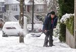
Myron Lee shovel, sidewalks in the Sylvan Hills neighborhood
Kristyna Wentz-Graff / OPB
“We’ve gotten so good at forecasting that when we do miss one it hurts,” she said. “It hurts us, it hurts the public and we just want to find those solutions.”
During Wednesday’s meeting, Fransen said the NWS may need to adopt virtual office hours throughout the day during serious storms and be flexible to rapid changes.
They also discussed using emergency text alerts to a select group of leaders, a tool Multnomah County has used broadly with the public during extreme weather, and that Director of Emergency Management Chris Voss said could help in these situations. But he said before the weather service uses this type of strategy, they need to ensure it’s the right tool to use for that moment. They would need to avoid sending false alarms.
“The question is: Where does the threshold exist where we think that an event has become so serious that we think that it’s necessary to pull out some of these other tools?” he said. “There’s still this danger about sending out messages based on forecasts.”
Voss said emergency alerts could be a risk for the NWS, but that type of system might be beneficial for people who are on the road and need to know quickly updated driving conditions and road closures.
Oregon may also need to upgrade its forecasting tools, according to State Climatologist Larry O’Neill. He said the state needs better climate models in the Willamette Valley to predict precipitation the region now receives.
“Some of the tools we have are kind of old, at least to the capability of the observations and the models,” he said. “I think the problem is that there’s just not enough of the right information.”
Since the Willamette Valley is so close to the ocean and the Cascades, temperatures can vary significantly, making predictions more difficult. According to the NWS, there are a few buoys on the coast that collect weather data. There are also ship observations and some satellite data. But radar observations start just as you get to the coast, making it hard to predict how much rain, freezing rain or snow could be coming.
“It becomes really important whether you’re below freezing or above freezing and in the valley, it’s particularly difficult to forecast because of how close we are to these either warm air sources of the ocean or colder air sources from east of the Cascades,” he said, calling the predictions “especially uncertain” compared to other parts of the U.S.
O’Neill expects the region will get more weather radars in the next decade to help deal with increasingly common extreme weather. But for now, he said, the National Weather Service can continue to improve how frequently its weather models forecast and send information to weather offices so they can share it with the public.

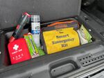
National Weather Service Portland meteorologist-in-charge Tanja Fransen keeps a survival kit in her car at all times. It includes a first aid kit, water, jumper cables, tiolet paper and a flashlight. During the winter months she keeps extra blankets and plastic to cover herself.
Monica Samayoa / OPB
Until Oregon improves how it predicts extreme weather and sends out warnings, people need to prepare for the unexpected. NWS Portland’s Fransen said extreme weather can happen at any time, whether that be next week, next year or in two years. She keeps a few items in her car at all times just in case of an emergency. Just like Bryant Jackson.
Jackson, 60, understands that need to be ready. He lived in the Portland area for more than 20 years before moving to Union County. He keeps an emergency survival kit in his car that includes flashlights, lighters, jumper cables, snacks and water. During the winter, he adds a shovel, and sleeping bags.
“What you keep or put in your car can vary depending on where you live or where you’re driving,” Jackson said. “But I feel like we should all be prepared mentally that we might need to stay in our car for a night at least and adding just a few items can make a big difference.”
Correction: This story has been updated to clarify who would receive the text alert messages being considered by the National Weather Service. OPB regrets the error.
